Image: Garrity

Size of this JPG preview of this TIF file: 800 × 453 pixels. Other resolution: 320 × 181 pixels.
Original image (951 × 538 pixels, file size: 878 KB, MIME type: image/tiff)
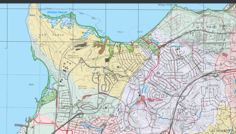
Description: This map shows the path of Garrity Creek from source to the San Francisco Bay. This image is an excerpt of the fantastic "Creek and Watershed Map of Richmond and Vicinity" published by the Oakland Museum of California in 2006.
Title: Garrity
Credit: Own work
Author: Achahrour
Usage Terms: Creative Commons Attribution-Share Alike 4.0
License: CC BY-SA 4.0
License Link: https://creativecommons.org/licenses/by-sa/4.0
Attribution Required?: Yes
Image usage
The following page links to this image:

All content from Kiddle encyclopedia articles (including the article images and facts) can be freely used under Attribution-ShareAlike license, unless stated otherwise.
