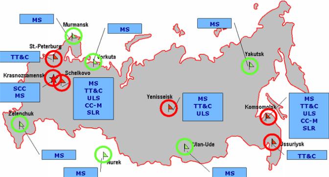
Image: GLONASS GroundSegment
GLONASS_GroundSegment.jpg (672 × 361 pixels, file size: 37 KB, MIME type: image/jpeg)
Description: Map depicting ground control stations
Title: GLONASS GroundSegment
Credit: http://www.navcen.uscg.gov/pdf/cgsicMeetings/48/Reports/International%20Subcommittee/%5B24%5D%20GLONASS%20CGSIC%2016.09.2008.pdf
Author: United States Coast Guard
Usage Terms: Public domain
License: Public domain
Attribution Required?: No
Image usage
The following page links to this image:

All content from Kiddle encyclopedia articles (including the article images and facts) can be freely used under Attribution-ShareAlike license, unless stated otherwise.

