
Image: Full Map of Yokohama Port by Hashimoto Sadahide 1859-1860
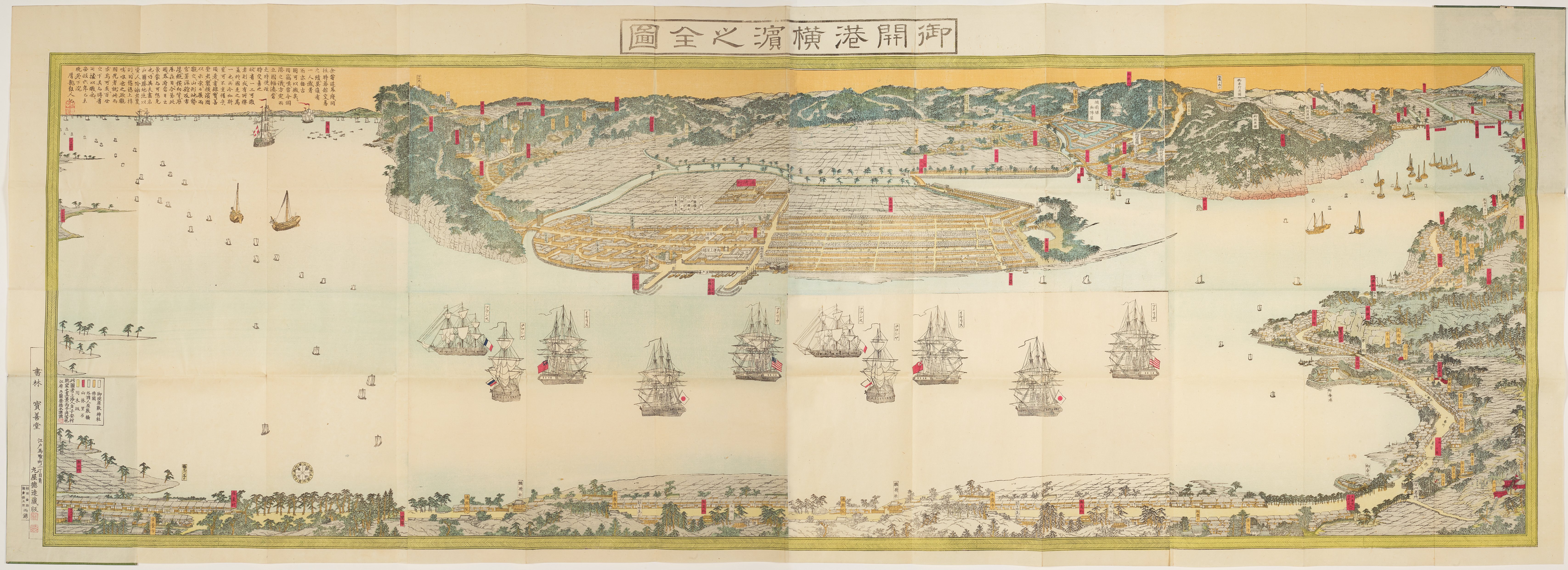
Description: “Gokaikō Yokohama no oezu” (Complete map of the open port of Yokohama) is a woodcut map of Yokohama port created by the artist, Hashimoto Sadahide (Utagawa Sadahide), in 1860 (or 1859). The artist uses the woodblock painting technique to print ink and color on paper. This pictorial map, showing Yokohama as seen from Koyasu village or Kanagawa across from the port, shows the harbour after its opening to foreign trade, with a highlight on foreign ships and consulates. The painting depicts steamships from France, Russia, Great Britain, Japan and the United States. In the 1850s, the Tokugawa government was forced by foreign pressure to negotiate trade agreements with the United States and with several European countries. A number of cities were selected as ‘open ports’ where foreigners, including diplomatic representatives, were allowed to reside and commerce. Yokohama was one of them.
Title: Full Map of Yokohama Port by Hashimoto Sadahide 1859-1860
Credit: https://places.branipick.com/view-of-yokohama-japan-after-opening-to-foreign-trade-1860/ , Higher resolution version at Manchester Digital Exhibitions - https://www.digitalexhibitions.manchester.ac.uk/s/travels-in-japan/item/326 (identifier: Japanese 107)
Author: Hashimoto Sadahide (Utagawa Sadahide)
Usage Terms: Public domain
License: Public domain
Attribution Required?: No
Image usage
The following page links to this image:
