
Image: Frezier Voyage Rade Callao
Size of this preview: 800 × 541 pixels. Other resolutions: 320 × 217 pixels | 1,784 × 1,207 pixels.
Original image (1,784 × 1,207 pixels, file size: 488 KB, MIME type: image/jpeg)
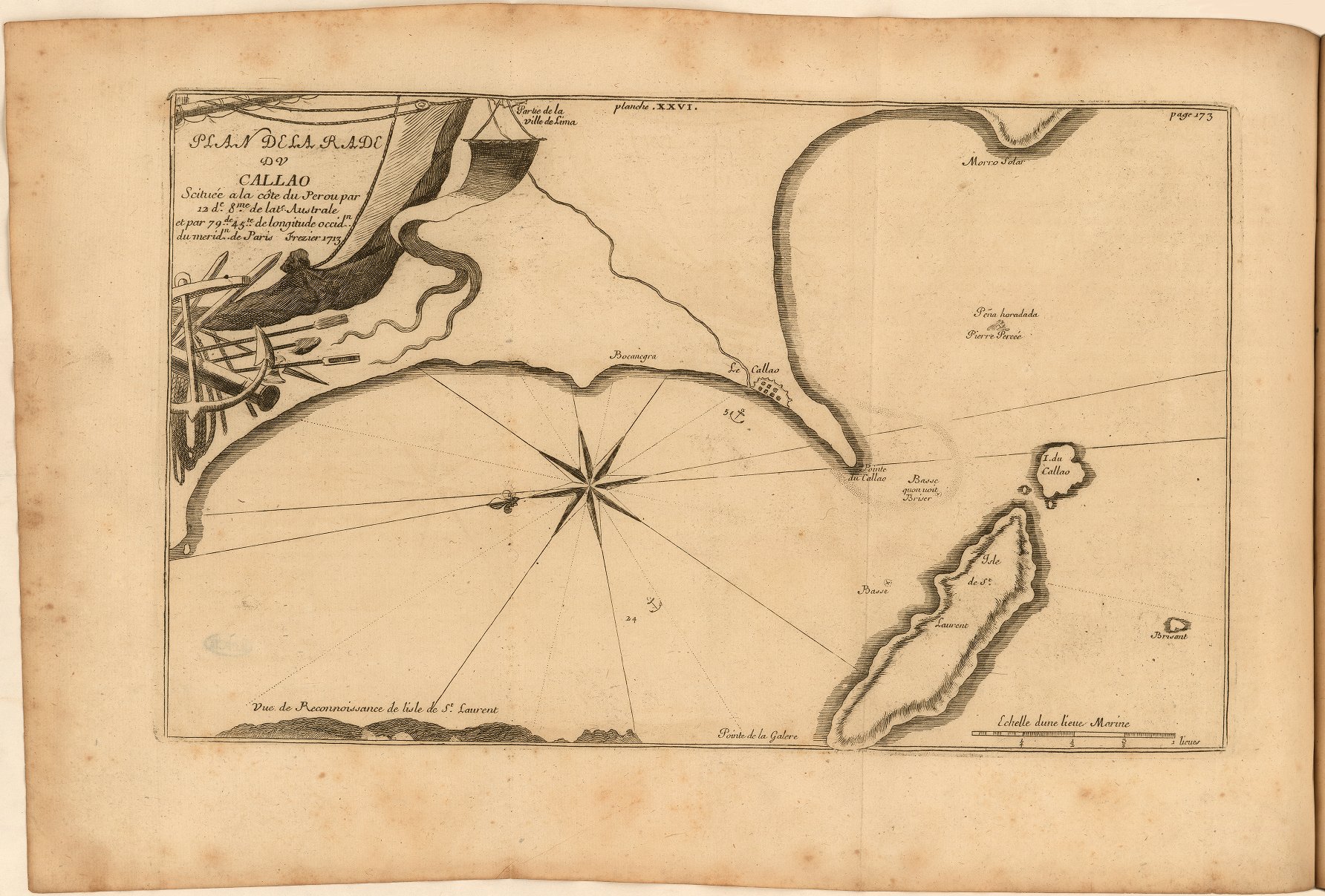
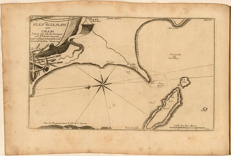
Description: Fold-out, engraved map of the bay of Callao in present-day Peru. Includes location of settlement with anchorage in the roads and soundings. Also includes scale, profile of mountains, and compass rose. Decorative cartouche includes anchor, sails, cannon, and ropes.
Title: Frezier Voyage Rade Callao
Credit: A voyage to the South-sea, and along the coasts of Chili and Peru, in the years 1712, 1713, and 1714. London: 1717. https://jcb.lunaimaging.com/luna/servlet/view/search/when/1717?q=E717+F896v&sort=normalized_date%2Cfile_name%2Csource_author%2Csource_title
Author: Amédée François Frézier
Usage Terms: Public domain
License: Public domain
Attribution Required?: No
Image usage
The following page links to this image:

All content from Kiddle encyclopedia articles (including the article images and facts) can be freely used under Attribution-ShareAlike license, unless stated otherwise.