
Image: Frezier Voyage Coquimbo
Size of this preview: 800 × 539 pixels. Other resolutions: 320 × 215 pixels | 1,803 × 1,214 pixels.
Original image (1,803 × 1,214 pixels, file size: 451 KB, MIME type: image/jpeg)
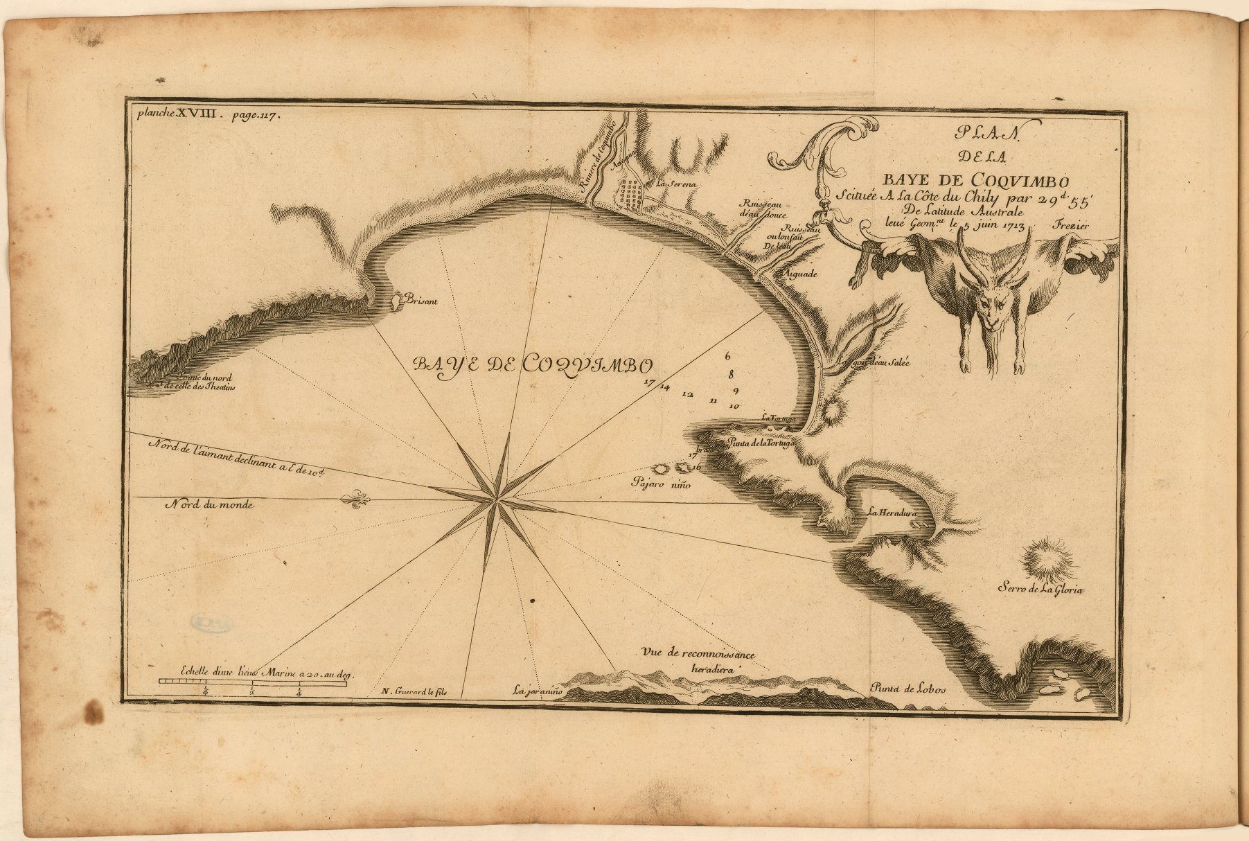
Description: Fold-out, engraved map of the bay of Coquimbo in present-day Chile, including location of the settlement of Coquimbo, roads, soundings, profiles of mountains, scale, and compass rose. Relief shown by hachures. Decorative cartouche includes the skin of a goat.
Title: Frezier Voyage Coquimbo
Credit: A voyage to the South-sea, and along the coasts of Chili and Peru, in the years 1712, 1713, and 1714. London: 1717. https://jcb.lunaimaging.com/luna/servlet/view/search/when/1717?q=E717+F896v&sort=normalized_date%2Cfile_name%2Csource_author%2Csource_title
Author: Amédée François Frézier
Usage Terms: Public domain
License: Public domain
Attribution Required?: No
Image usage
The following page links to this image:

All content from Kiddle encyclopedia articles (including the article images and facts) can be freely used under Attribution-ShareAlike license, unless stated otherwise.