
Image: French Indochina 1937
Size of this preview: 387 × 599 pixels. Other resolutions: 155 × 240 pixels | 1,292 × 2,000 pixels.
Original image (1,292 × 2,000 pixels, file size: 508 KB, MIME type: image/png)
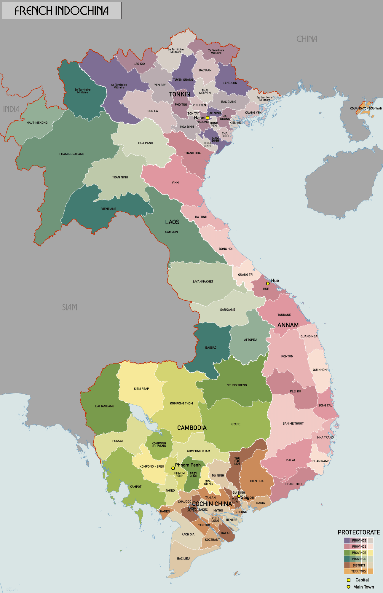
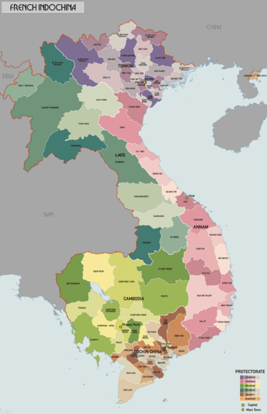
Description: Administrative map of French Indochina in 1937. Showing protectorates and provinces/districts. Source map data: AMS 509 (Indochina & Thailand) 1:250k (PCL Map collection). Reseau Routier de l'Indochine 1:2m (BNF).
Title: French Indochina 1937
Credit: Own work
Author: XrysD
Usage Terms: Creative Commons Attribution-Share Alike 4.0
License: CC BY-SA 4.0
License Link: http://creativecommons.org/licenses/by-sa/4.0
Attribution Required?: Yes
Image usage
The following page links to this image:

All content from Kiddle encyclopedia articles (including the article images and facts) can be freely used under Attribution-ShareAlike license, unless stated otherwise.