
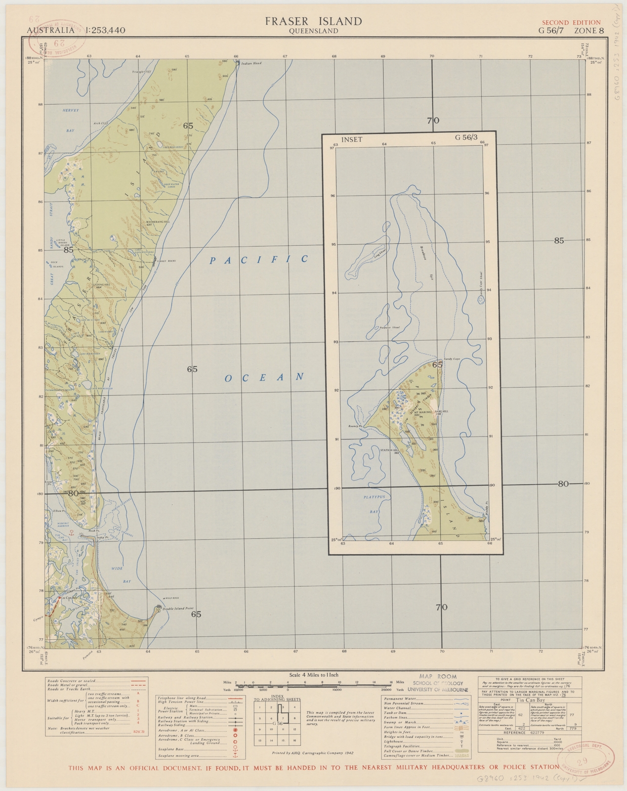
Image: Fraser Island Topo Map 1942
Size of this preview: 475 × 599 pixels. Other resolutions: 190 × 240 pixels | 5,000 × 6,306 pixels.
Original image (5,000 × 6,306 pixels, file size: 13.73 MB, MIME type: image/jpeg)
Description: Topographic map sheet Fraser Island, scale 1:253,440, G 56/7 Zone 8, E 153⁰00'--E 154⁰00'/S 25⁰00'--S 26⁰00', original size 47 x 43 cm., on sheet 59 x 46 cm.
Title: Fraser Island Topo Map 1942
Credit: https://nla.gov.au/nla.obj-234104792/view
Author: A.H.Q. [Australian Headquarters] Cartographic Coy. [Company]
Usage Terms: Public domain
License: Public domain
Attribution Required?: No
Image usage
The following 2 pages link to this image:

All content from Kiddle encyclopedia articles (including the article images and facts) can be freely used under Attribution-ShareAlike license, unless stated otherwise.