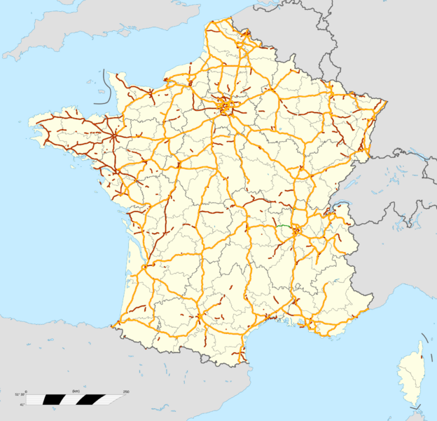
Image: France autoroutes map-fr

Description: Map of motorways of France, with regions and departements distinguished. Approximate scale : 1:3,000,000
Title: France autoroutes map-fr
Credit: Own work autoroutes/motorways : données de la carte © les contributeurs d'OpenStreetMap, CC-BY-SA Openstreetmap via mapcruzin.com ; Shoreline and international boundaries: World Data Base II (public domain) ; Internal boundaries: taken from Image:Contours_des_départements_français_(Mercator).svg (re-projected) created by user:Wagner51 with free IGN data.
Author: Bourrichon (motorways) ; fond de carte / bottom map : File:France location map-Regions and departements.svg by Sting - fr:Sting
Usage Terms: Creative Commons Attribution 3.0
License: CC BY 3.0
License Link: https://creativecommons.org/licenses/by/3.0
Attribution Required?: Yes
Image usage
The following page links to this image:

