
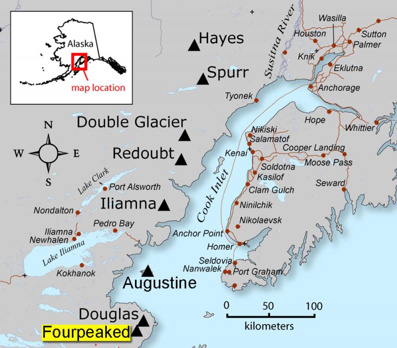
Image: Fourpeaked-map1
Size of this preview: 684 × 599 pixels. Other resolutions: 274 × 240 pixels | 800 × 701 pixels.
Original image (800 × 701 pixels, file size: 82 KB, MIME type: image/jpeg)
Description: AVO map shows the location of Fourpeaked volcano
Title: Fourpeaked-map1
Credit: Map created by Seth Snedigar and Janet Schaafer for the United States Geological Survey's Alaska Volcano Observatory and the Alaska Division of Geological & Geophysical Surveys
Author: Seth Snedigar and Janet Schaafer for the United States Geological Survey's Alaska Volcano Observatory and the Alaska Division of Geological & Geophysical Surveys
Usage Terms: Public domain
License: Public domain
Attribution Required?: No
Image usage
The following 2 pages link to this image:

All content from Kiddle encyclopedia articles (including the article images and facts) can be freely used under Attribution-ShareAlike license, unless stated otherwise.