
Image: Fossil Creek proposal map

Size of this preview: 388 × 600 pixels. Other resolutions: 155 × 240 pixels | 1,099 × 1,699 pixels.
Original image (1,099 × 1,699 pixels, file size: 2.04 MB, MIME type: image/png)
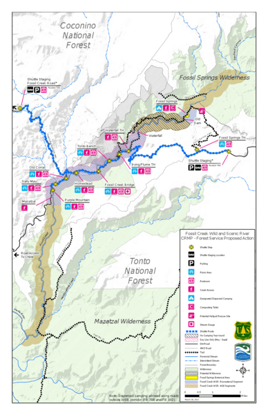
Description: Map of the Fossil Creek watershed in the U.S. state of Arizona showing existing features as well as proposed features
Title: Fossil Creek proposal map
Credit: Fossil Creek Wild and Scenic River CRMP - Forest Service Proposed Action; converted from PDF to PNG format by User:Finetooth using GNU Image Manipulation Program (GIMP) software
Author: United States Forest Service and National Wild and Scenic Rivers System
Usage Terms: Public domain
License: Public domain
Attribution Required?: No
Image usage
The following page links to this image:

All content from Kiddle encyclopedia articles (including the article images and facts) can be freely used under Attribution-ShareAlike license, unless stated otherwise.