
Image: Fort Poualak map
Size of this preview: 527 × 599 pixels. Other resolutions: 211 × 240 pixels | 673 × 765 pixels.
Original image (673 × 765 pixels, file size: 78 KB, MIME type: image/jpeg)
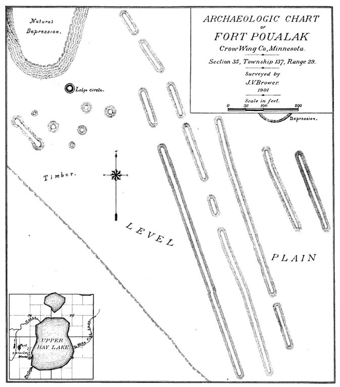
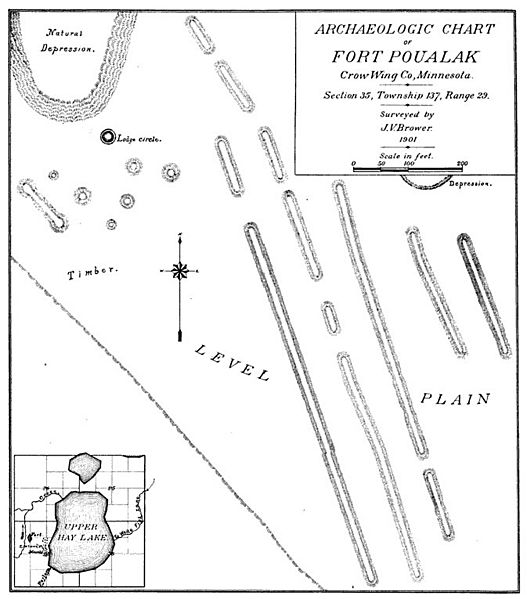
Description: Map of Upper Hay Lake mounds (a.k.a. Fort Poualak) made by Jacob V. Brower and published in 1901.
Title: Fort Poualak map
Credit: Memoirs of Explorations in the Basin of the Mississippi, vol. 4: Kathio
Author: Jacob V. Brower
Usage Terms: Public domain
License: Public domain
Attribution Required?: No
Image usage
The following 2 pages link to this image:

All content from Kiddle encyclopedia articles (including the article images and facts) can be freely used under Attribution-ShareAlike license, unless stated otherwise.