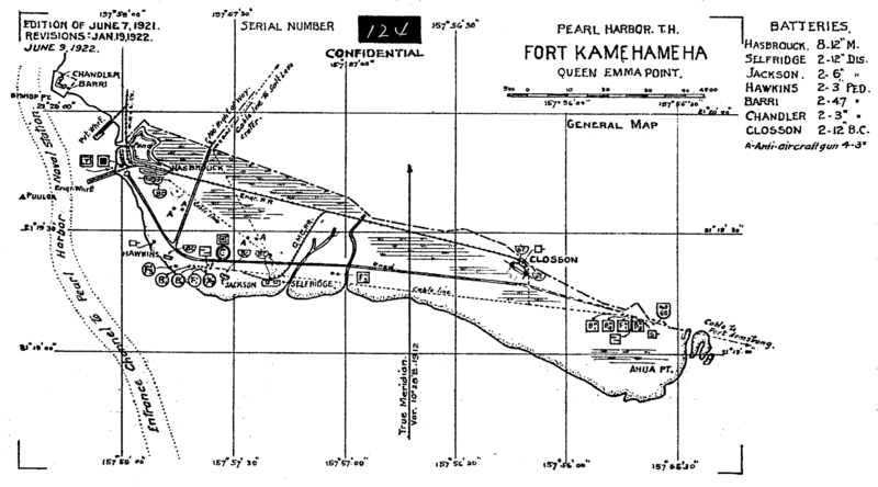
Image: Fort Kamehameha map 1922

Size of this preview: 800 × 444 pixels. Other resolutions: 320 × 177 pixels | 2,788 × 1,546 pixels.
Original image (2,788 × 1,546 pixels, file size: 251 KB, MIME type: image/gif)
Description: The coastal defenses of Pearl Harbor, constructed between World War I and World War II were called "Fort Kamehameha". The large guns were useless in the attack of 1941, although one "Zero" was shot down by anti-aircraft guns. It is now part of Hickham Air Force base.
Title: Fort Kamehameha map 1922
Credit: U.S. Army map of Fort Kamehameha from 1922, The Coast Defense Study Group. http://www.cdsg.org/mapspdf/HDHI1921.pdf
Author: U.S. Army
Usage Terms: Public domain
License: Public domain
Attribution Required?: No
Image usage
The following page links to this image:

All content from Kiddle encyclopedia articles (including the article images and facts) can be freely used under Attribution-ShareAlike license, unless stated otherwise.
