
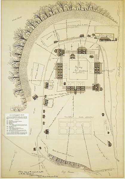
Image: Fort Dearborn 1808

Size of this preview: 419 × 600 pixels. Other resolutions: 168 × 240 pixels | 1,600 × 2,290 pixels.
Original image (1,600 × 2,290 pixels, file size: 940 KB, MIME type: image/jpeg)
Description: Map of Fort Dearborn in January 1808 by Captain John Whistler, commandant of the fort.
Title: Fort Dearborn 1808
Credit: Scanned by User:JeremyA from Holland, Robert A. (2005) "Chicago in Maps, 1612 to 2002"
Author: John Whistler (1756–1829)
Permission: Public domain: 1—it is a work of the United States Federal Government; 2—the author died more than 100 years ago; 3—the map was first published in the United States before 1923
Usage Terms: Public domain
License: Public domain
Attribution Required?: No
Image usage
The following 2 pages link to this image:

All content from Kiddle encyclopedia articles (including the article images and facts) can be freely used under Attribution-ShareAlike license, unless stated otherwise.