
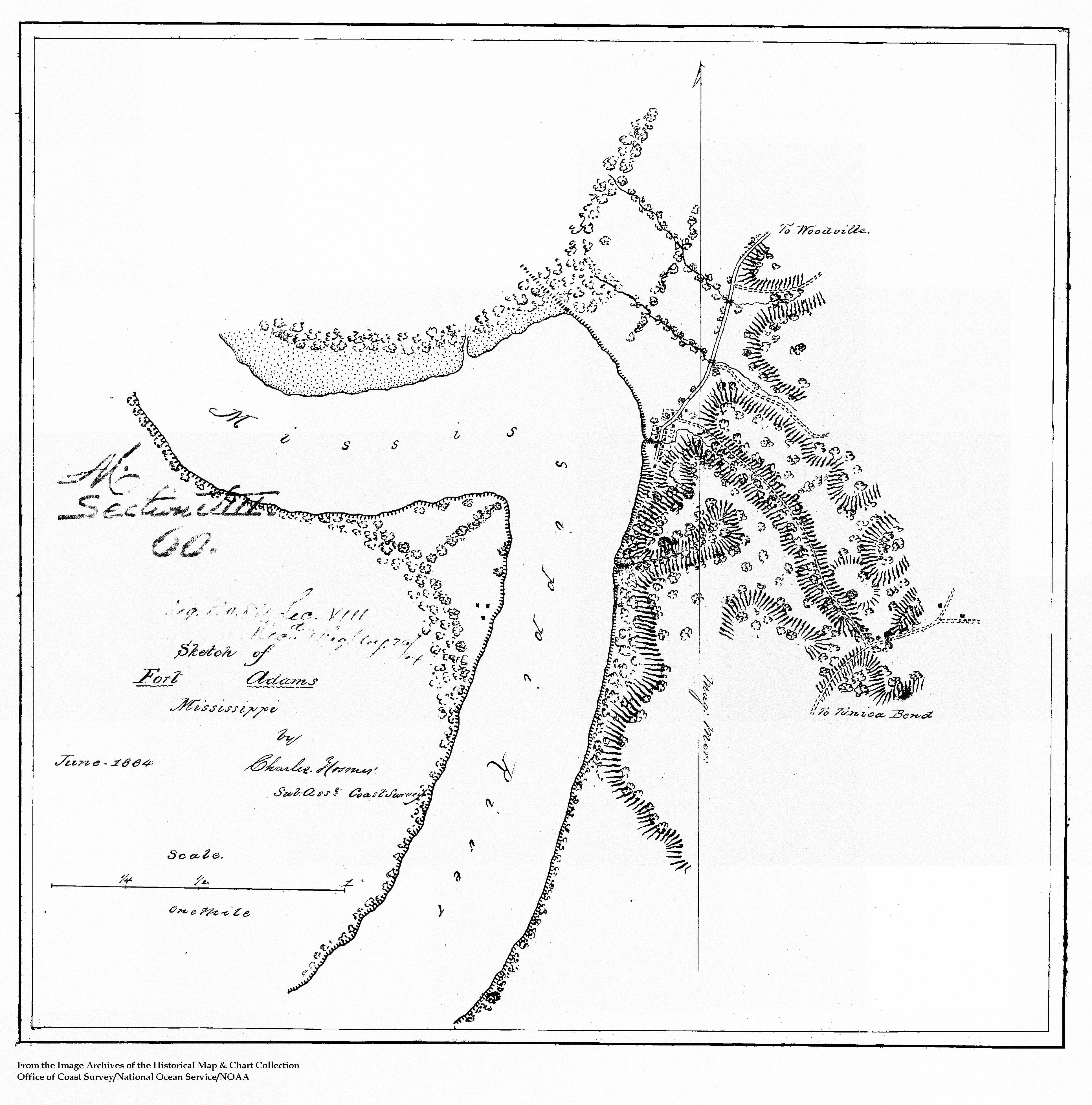
Image: FortAdamsMississippiMap
Size of this preview: 593 × 600 pixels. Other resolutions: 237 × 240 pixels | 3,871 × 3,916 pixels.
Original image (3,871 × 3,916 pixels, file size: 2.08 MB, MIME type: image/jpeg)
Description: Map of Fort Adams, Mississippi
Title: FortAdamsMississippiMap
Credit: http://historicals.ncd.noaa.gov/historicals/histmap.asp?chart=&keyword=&send=Submit+Query&state=MS&type=&year=
Author: From the NOAA Image Archives of the Historical Map & Chart Collection
Permission: Public domain
Usage Terms: Public domain
License: Public domain
Attribution Required?: No
Image usage
The following page links to this image:

All content from Kiddle encyclopedia articles (including the article images and facts) can be freely used under Attribution-ShareAlike license, unless stated otherwise.