
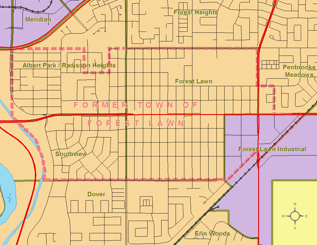
Image: Forest Lawn 1960 boundaries
Size of this preview: 776 × 600 pixels. Other resolutions: 311 × 240 pixels | 1,056 × 816 pixels.
Original image (1,056 × 816 pixels, file size: 55 KB, MIME type: image/png)
Description: Boundaries of the former Town of Forest Lawn circa 1960 (based on 1960 Alberta official road map's Calgary inset) as compared with current Calgary official neighbourhood boundaries, existing roads and hydrography.
Title: Forest Lawn 1960 boundaries
Credit: Own work
Author: Hwy43
Usage Terms: Creative Commons Attribution 3.0
License: CC BY 3.0
License Link: http://creativecommons.org/licenses/by/3.0
Attribution Required?: Yes
Image usage
The following page links to this image:

All content from Kiddle encyclopedia articles (including the article images and facts) can be freely used under Attribution-ShareAlike license, unless stated otherwise.