
Image: Fontevraud Abbey map-en

Size of this PNG preview of this SVG file: 704 × 600 pixels. Other resolution: 282 × 240 pixels.
Original image (SVG file, nominally 2,650 × 2,258 pixels, file size: 92 KB)
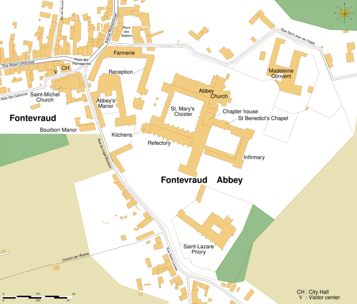
Description: Map of Fontevraud Abbey, Maine-et-Loire, Pays de la Loire, France.
Title: Fontevraud Abbey map-en
Credit: See the image in its original context on OpenStreetMap.
Author: OpenStreetMap contributors Sémhur (talk)
Permission: All OpenStreetMap data and maps are Creative Commons "CC-BY-SA 2.0" licensed.
Usage Terms: Creative Commons Attribution-Share Alike 4.0
License: CC BY-SA 4.0
License Link: https://creativecommons.org/licenses/by-sa/4.0
Attribution Required?: Yes
Image usage
The following page links to this image:

All content from Kiddle encyclopedia articles (including the article images and facts) can be freely used under Attribution-ShareAlike license, unless stated otherwise.