
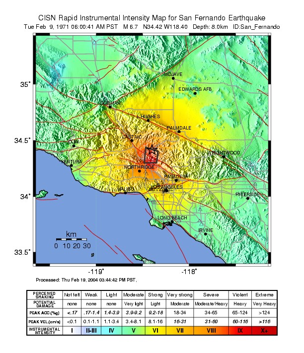
Image: February 1971 San Fernando earthquake intensity USGS
Size of this preview: 516 × 599 pixels. Other resolutions: 207 × 240 pixels | 612 × 711 pixels.
Original image (612 × 711 pixels, file size: 163 KB, MIME type: image/jpeg)
Description: The 1971 San Fernando earthquake, also known as the Sylmar earthquake — Los Angeles County, Southern California. Shake map of the magnitude 6.7 earthquake occurring in the San Fernando Valley on February 9, 1971. Epicenter marked at star. Realized by USGS on February 19, 2004.
Title: February 1971 San Fernando earthquake intensity USGS
Credit: USGS
Author: USGS
Usage Terms: Public domain
License: Public domain
Attribution Required?: No
Image usage
The following page links to this image:

All content from Kiddle encyclopedia articles (including the article images and facts) can be freely used under Attribution-ShareAlike license, unless stated otherwise.