
Image: Farset river map
No higher resolution available.
Farset_river_map.jpg (451 × 450 pixels, file size: 94 KB, MIME type: image/jpeg)
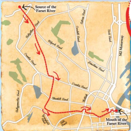
Description: A map showing the course of the Farset river, from Ballysillan in North Belfast to it's outlet into the Lagan in the city centre.
Title: Farset river map
Credit: Own work
Author: Citizen69
Usage Terms: Creative Commons Attribution-Share Alike 4.0
License: CC BY-SA 4.0
License Link: https://creativecommons.org/licenses/by-sa/4.0
Attribution Required?: Yes
Image usage
The following page links to this image:

All content from Kiddle encyclopedia articles (including the article images and facts) can be freely used under Attribution-ShareAlike license, unless stated otherwise.