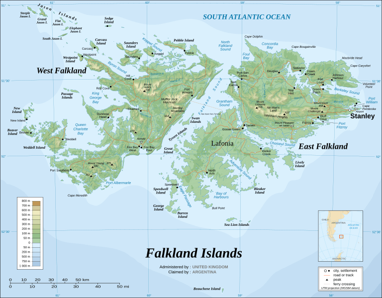
Image: Falkland Islands topographic map-en

Size of this PNG preview of this SVG file: 768 × 599 pixels. Other resolution: 308 × 240 pixels.
Original image (SVG file, nominally 2,550 × 1,990 pixels, file size: 1.91 MB)
Description: The Falkland Islands are an archipelago in the South Atlantic Ocean, located 300 miles off the coast of Argentina. They consist of two main islands, East Falkland and West Falkland, together with about 700 smaller islands. Stanley, on East Falkland, is the capital and largest city. The islands are a self-governing Overseas Territory of the United Kingdom.
Author: Eric Gaba (Sting - fr:Sting)
Usage Terms: Creative Commons Attribution-Share Alike 3.0
License: CC-BY-SA-3.0
License Link: http://creativecommons.org/licenses/by-sa/3.0/
Attribution Required?: Yes
Image usage
The following 17 pages link to this image:
- Adventure Sound
- Bay of Harbours
- Byron Sound
- Climate of the Falkland Islands
- Falkland Islands
- Foul Bay, Falkland Islands
- Geology of the Falkland Islands
- History of the Special Air Service
- Keppel Sound
- King George Bay
- Lafonia
- MacBride Head
- Port Albemarle
- Port William, Falkland Islands
- Queen Charlotte Bay
- United Nations Security Council Resolution 502
- West Falkland

All content from Kiddle encyclopedia articles (including the article images and facts) can be freely used under Attribution-ShareAlike license, unless stated otherwise.
