
Image: Falkland Islands regions map
Size of this preview: 800 × 520 pixels. Other resolutions: 320 × 208 pixels | 3,008 × 1,956 pixels.
Original image (3,008 × 1,956 pixels, file size: 1.66 MB, MIME type: image/png)
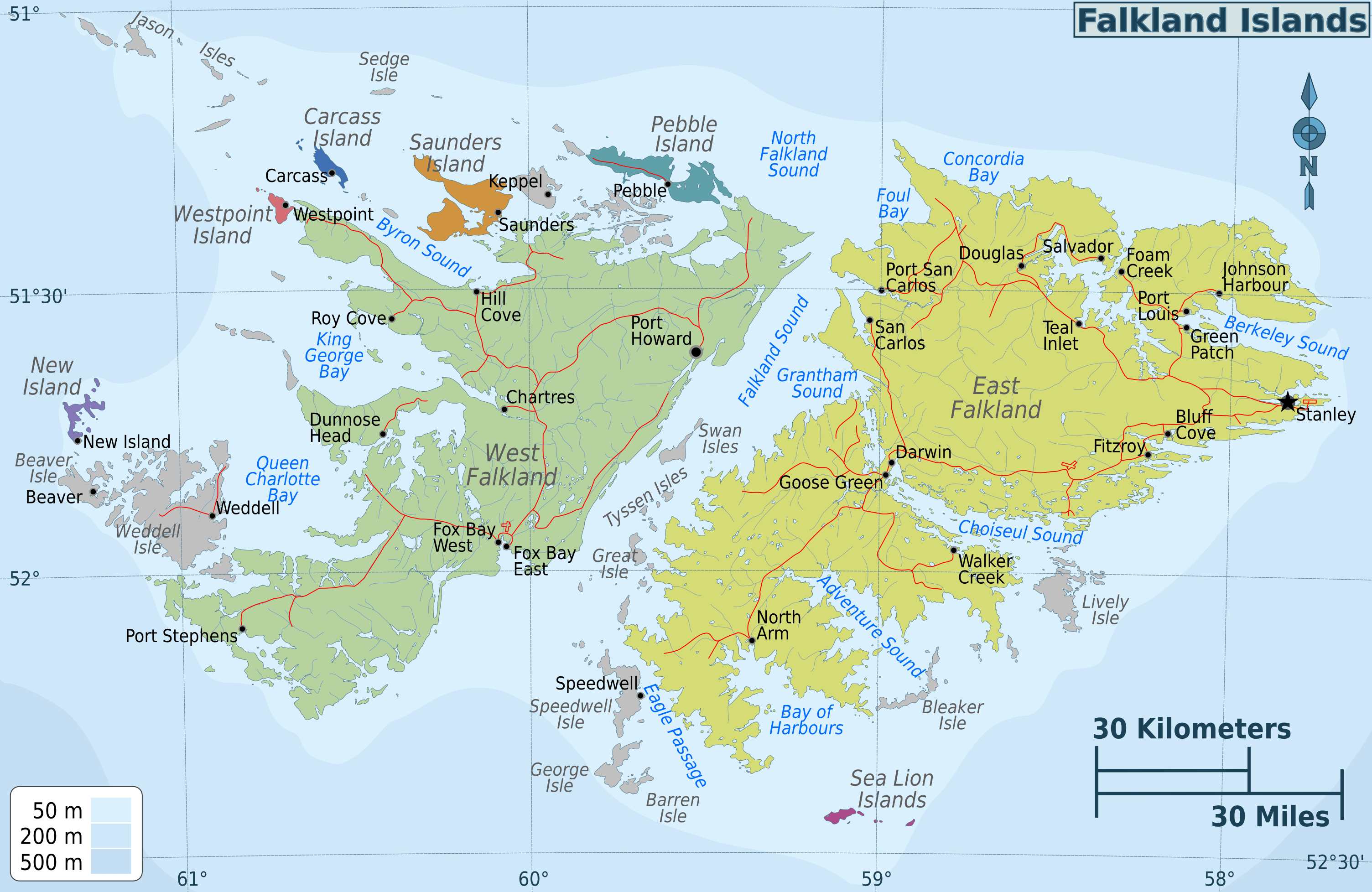
Description: Falkland Islands regions map for use on Wikivoyage, English version
Title: Falkland Islands regions map
Credit: Own work based on the topographic map by Eric Gaba
Author: Peter Fitzgerald
Usage Terms: Creative Commons Attribution-Share Alike 4.0
License: CC BY-SA 4.0
License Link: https://creativecommons.org/licenses/by-sa/4.0
Attribution Required?: Yes
Image usage

All content from Kiddle encyclopedia articles (including the article images and facts) can be freely used under Attribution-ShareAlike license, unless stated otherwise.