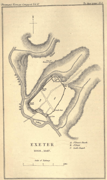
Image: Exeter 1068-1087, map published 1874

Size of this preview: 358 × 599 pixels. Other resolutions: 143 × 240 pixels | 533 × 892 pixels.
Original image (533 × 892 pixels, file size: 352 KB, MIME type: image/png)
Description: Map showing the defences of the city of Exeter in Devon, including the Roman city walls and Rougemont Castle, built by the Normans following the siege of 1067.
Title: Exeter 1068-1087, map published 1874
Credit: Freeman, Edward Augustus (1874). The History of the Norman Conquest of England, its Causes and its Results: Volume IV. Oxford: The Clarendon Press (facing p. 152). https://archive.org/details/historyofnormanc04freeuoft/page/152/mode/2up
Author: Unknown authorUnknown author
Usage Terms: Public domain
License: Public domain
Attribution Required?: No
Image usage
The following page links to this image:

All content from Kiddle encyclopedia articles (including the article images and facts) can be freely used under Attribution-ShareAlike license, unless stated otherwise.
