
Image: Europe in Africa in the nineteenth century (1895) (14584071758)
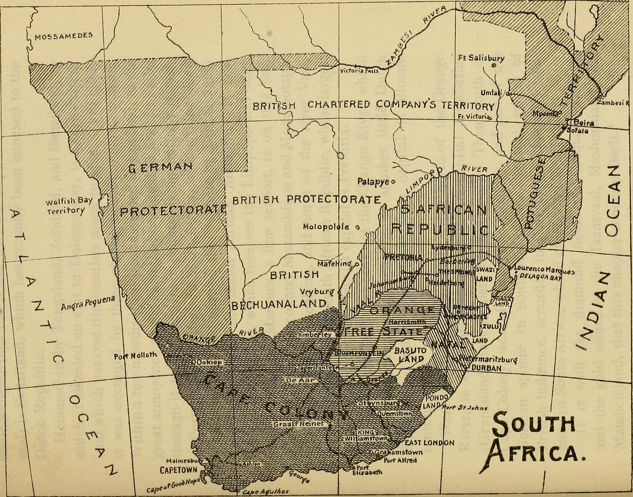
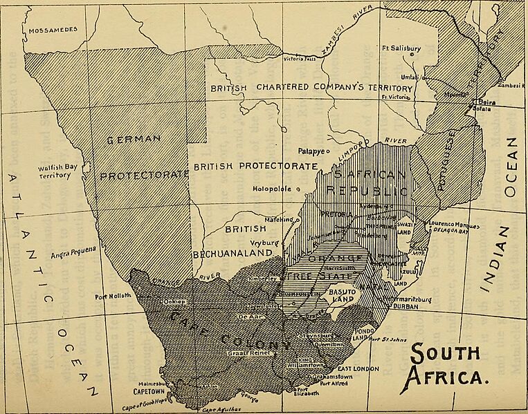
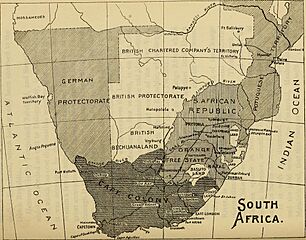
Description: Identifier: europeinafricain01lati (find matches) Title: Europe in Africa in the nineteenth century Year: 1895 (1890s) Authors: Latimer, Elizabeth Wormeley, 1822-1904 Subjects: Publisher: Chicago, A.C. McClurg and company Contributing Library: The Library of Congress Digitizing Sponsor: The Library of Congress View Book Page: Book Viewer About This Book: Catalog Entry View All Images: All Images From Book Click here to view book online to see this illustration in context in a browseable online version of this book. Text Appearing Before Image: of Natal is a small native state, Pondoland, whichis enclosed on three sides by British territory, and on itsremaining border has a seacoast with a fine port called St.Johns, which was reserved by treaty to Cape Colony. AnEnglish resident is stationed there. The present chief ofPondoland is a young man v/hose grandfather was one ofthe most savage tyrants on record, even in Africa. North of Cape Colony, on the eastern coast, is Natal, astate which, in 1S93, acquired responsible government.The Drakenberg chain of mountains runs down this partof Africa, one hundred to one hundred and fifty miles fromthe sea, and forms the western boundary of Natal. Theclimate of Natal is tropical for about fifteen miles fromthe coast; but beyond this it becomes temperate as theland rises in a series of terraces, ending in a lofty table-land. North of Natal, with a long coast line but no seaport,lies Zululand, now under British protection. To its north,on the borders of the Portuguese sphere of influence, Text Appearing After Image: DIAMOND FIELDS AND GOLD MINES. 347 lies a small district called Anatongaland or Tongaland;while wedged into the South African Republic (or Trans-vaal) is Swaziland, which has recently been annexed to theDutch Republic. Hemmed in by Tongaland, Zululand, and Swaziland, towhich it afforded an exit to Delagoa Bay, is a tiny strip ofland which has cost diplomatists much trouble. Till latelyit was occupied by three chiefs, one of them a woman.Within a few months it has been assigned to England, to thegreat annoyance of the Boers, who wanted to find an outletthrough it to the sea, their country lying entirely inland. Portuguese territory in East Africa, with a long coastline, lies north and east of the sphere of British influ-ence and east of the South African Republic. It pos-sesses Delagoa Bay, which receives the Limpopo and otherrivers. Lorenzo Marquez, a fine seaport, is on this bay.We used to call the country Mozambique and Monomotapa. West of the Drakenberg, and north of the river Vaal Note About Images Please note that these images are extracted from scanned page images that may have been digitally enhanced for readability - coloration and appearance of these illustrations may not perfectly resemble the original work.
Title: Europe in Africa in the nineteenth century (1895) (14584071758)
Credit: https://www.flickr.com/photos/internetarchivebookimages/14584071758/ Source book page: https://archive.org/stream/europeinafricain01lati/europeinafricain01lati#page/n391/mode/1up
Author: Internet Archive Book Images
Permission: At the time of upload, the image license was automatically confirmed using the Flickr API. For more information see Flickr API detail.
Usage Terms: No known copyright restrictions
License: No restrictions
License Link: https://www.flickr.com/commons/usage/
Attribution Required?: No
Image usage
The following page links to this image:

_(14584071758).jpg)