
Image: Europe 843ad viking incursions map
Size of this preview: 800 × 432 pixels. Other resolutions: 320 × 173 pixels | 2,621 × 1,414 pixels.
Original image (2,621 × 1,414 pixels, file size: 738 KB, MIME type: image/png)
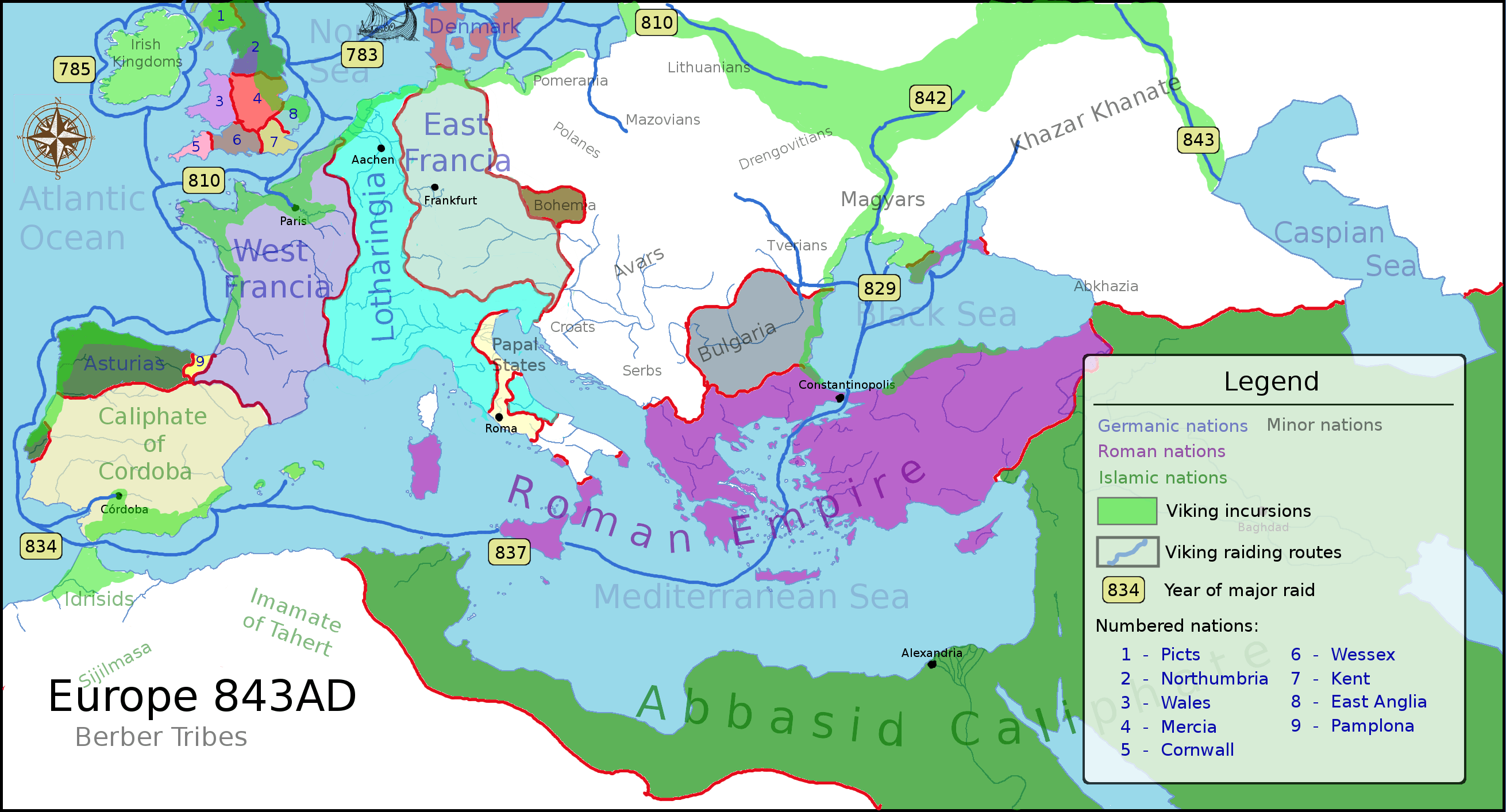
Description: A political map of Europe featuring areas of major Viking incursions and the dates of famous Vikings raids.
Title: Europe 843ad viking incursions map
Credit: Own work
Author: Adhavoc
Usage Terms: Creative Commons Attribution-Share Alike 3.0
License: CC BY-SA 3.0
License Link: https://creativecommons.org/licenses/by-sa/3.0
Attribution Required?: Yes
Image usage
The following page links to this image:

All content from Kiddle encyclopedia articles (including the article images and facts) can be freely used under Attribution-ShareAlike license, unless stated otherwise.