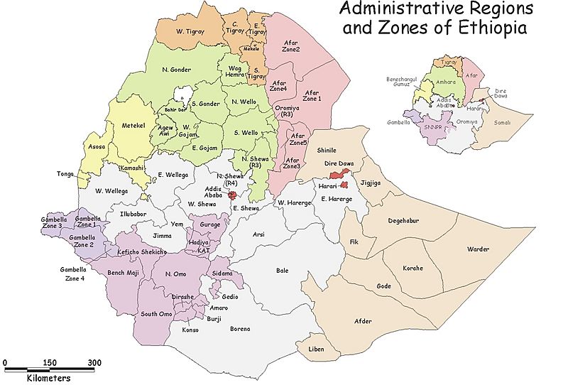
Image: Ethiopia zone region

Size of this preview: 800 × 542 pixels. Other resolutions: 320 × 217 pixels | 1,246 × 844 pixels.
Original image (1,246 × 844 pixels, file size: 266 KB, MIME type: image/jpeg)
Description: Map of regions and zones in Ethiopia as of April 2000. All boundaries are approximate and unofficial.
Title: Ethiopia zone region
Credit: USAID/Ehiopia Map Room
Author: UN Emergencies Unit for Ethiopia
Permission: "In return, we request only that USAID be cited as the source of any information, photos, and images copied from this site and that any photo credits or bylines be similarly credited to the photographer or author." Quote taken from Privacy
Usage Terms: Copyrighted free use
License: Copyrighted free use
License Link: //commons.wikimedia.org/wiki/File:Ethiopia_zone_region.jpg
Image usage
The following page links to this image:

All content from Kiddle encyclopedia articles (including the article images and facts) can be freely used under Attribution-ShareAlike license, unless stated otherwise.
