
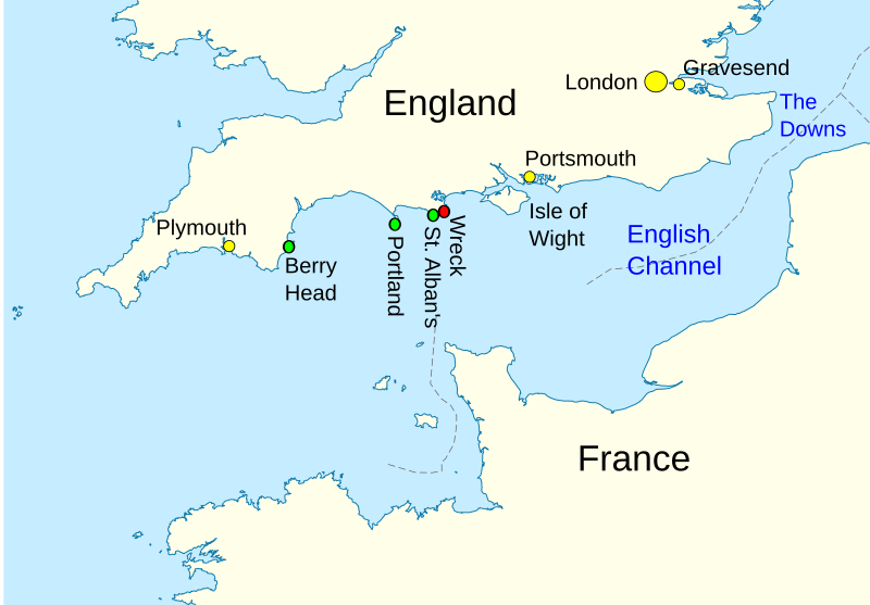
Image: English Channel location map - Halsewell

Size of this PNG preview of this SVG file: 800 × 557 pixels. Other resolution: 320 × 223 pixels.
Original image (SVG file, nominally 955 × 665 pixels, file size: 192 KB)
Description: English channel showing locations relevant to the last voyage of en:Halsewell (East Indiaman)
Title: English Channel location map - Halsewell
Credit: File:English Channel location map.svg (adapted)
Author: User:NordNordWest (original), User:Aymatth2 (annotations)
Usage Terms: Creative Commons Attribution-Share Alike 3.0
License: CC BY-SA 3.0
License Link: https://creativecommons.org/licenses/by-sa/3.0
Attribution Required?: Yes
Image usage
The following page links to this image:

All content from Kiddle encyclopedia articles (including the article images and facts) can be freely used under Attribution-ShareAlike license, unless stated otherwise.