
Image: England North-South divide map (Danny Dorling version) 01
Size of this preview: 494 × 600 pixels. Other resolutions: 198 × 240 pixels | 816 × 991 pixels.
Original image (816 × 991 pixels, file size: 53 KB, MIME type: image/png)
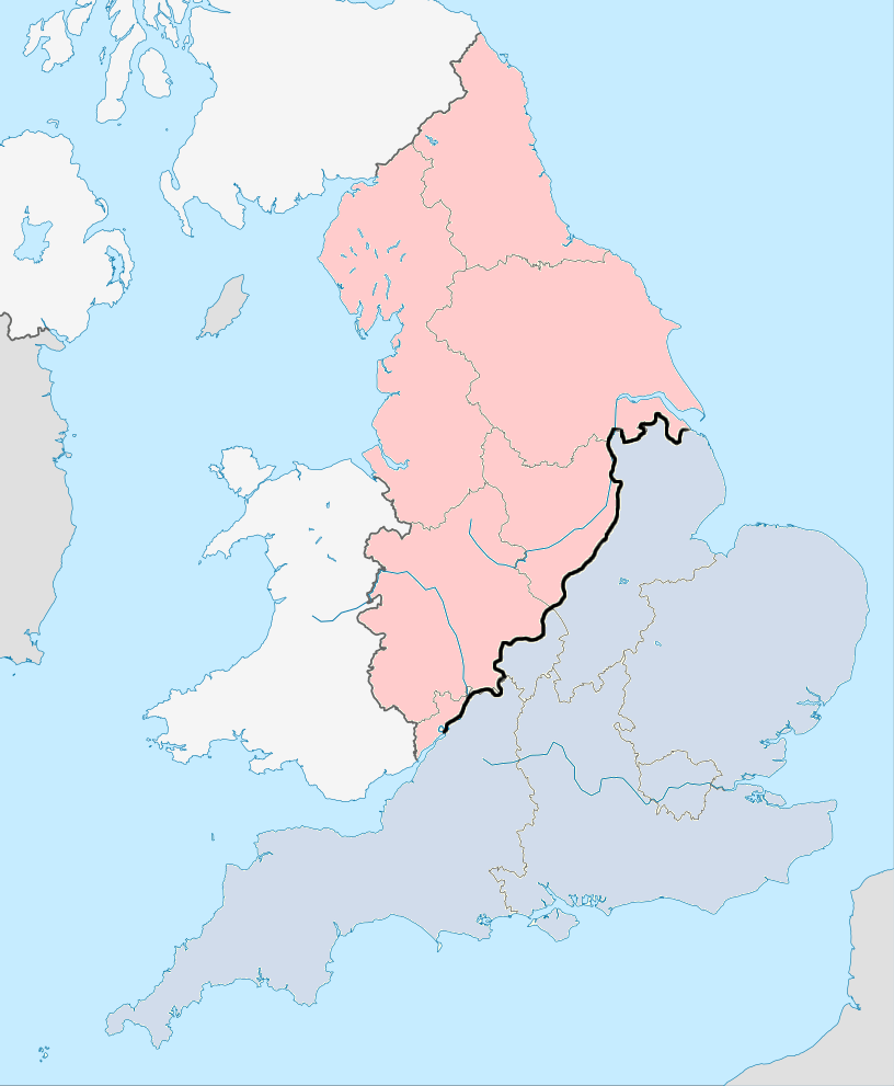
Description: North-South dividing line defined by former Geography professor at the University of Sheffield Danny Dorling. Sourceː https://www.dannydorling.org/wp-content/files/dannydorling_publication_id2881.pdf
Title: England North-South divide map (Danny Dorling version) 01
Credit: Own work
Author: Foxy1219
Usage Terms: Creative Commons Attribution-Share Alike 4.0
License: CC BY-SA 4.0
License Link: https://creativecommons.org/licenses/by-sa/4.0
Attribution Required?: Yes
Image usage
The following page links to this image:

All content from Kiddle encyclopedia articles (including the article images and facts) can be freely used under Attribution-ShareAlike license, unless stated otherwise.
_01.png)