
Image: Elland Road Bridge, Ripponden. - geograph.org.uk - 224639
Size of this preview: 444 × 599 pixels. Other resolutions: 178 × 240 pixels | 474 × 640 pixels.
Original image (474 × 640 pixels, file size: 125 KB, MIME type: image/jpeg)
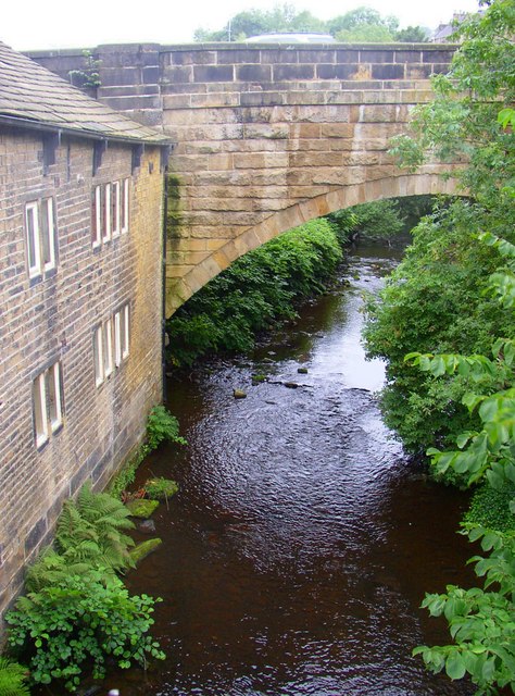
Description: Elland Road Bridge, Ripponden. This Grade II listed bridge over the River Ryburn was built in 1772 as part of a turnpike road. It was widened and altered in the mid-19C. It also has two smaller land arches on the eastern side, giving access to cottages. The river is the boundary between Barkisland and Soyland townships. These became Urban Districts, and were merged as Ripponden UDC in 1937.
Title: Elland Road Bridge, Ripponden. - geograph.org.uk - 224639
Credit: From geograph.org.uk
Author: Humphrey Bolton
Usage Terms: Creative Commons Attribution-Share Alike 2.0
License: CC BY-SA 2.0
License Link: https://creativecommons.org/licenses/by-sa/2.0
Attribution Required?: Yes
Image usage
The following page links to this image:

All content from Kiddle encyclopedia articles (including the article images and facts) can be freely used under Attribution-ShareAlike license, unless stated otherwise.