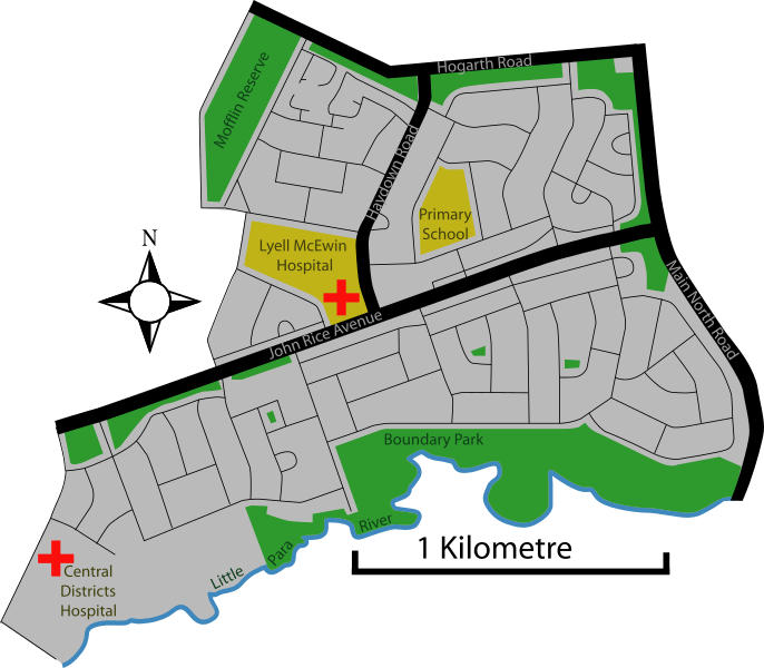
Image: Elizabeth Vale Adelaide streetmap

Size of this PNG preview of this SVG file: 686 × 599 pixels. Other resolution: 275 × 240 pixels.
Original image (SVG file, nominally 838 × 732 pixels, file size: 154 KB)
Description: Street map of Elizabeth Vale, Adelaide, South Australia Correct as of at least 2000 and probably 2007 Some liberty taken with the river as it lies just on the other side of the council boundary in Salisbury Park
Title: Elizabeth Vale Adelaide streetmap
Credit: Own work
Author: Peripitus
Usage Terms: Creative Commons Attribution-Share Alike 3.0
License: CC BY-SA 3.0
License Link: http://creativecommons.org/licenses/by-sa/3.0
Attribution Required?: Yes
Image usage
The following page links to this image:

All content from Kiddle encyclopedia articles (including the article images and facts) can be freely used under Attribution-ShareAlike license, unless stated otherwise.
