
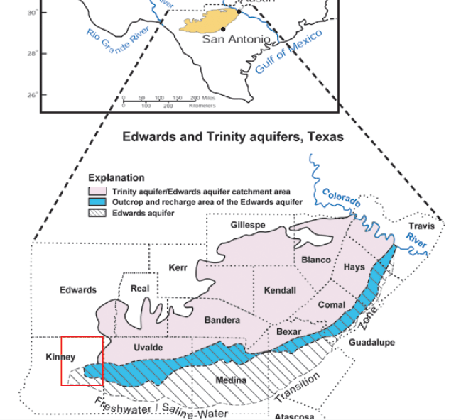
Image: Edwards and Trinity Aquifers Map
No higher resolution available.
Edwards_and_Trinity_Aquifers_Map.png (649 × 592 pixels, file size: 206 KB, MIME type: image/png)
Description: Edwards and Trinity Aquifers Map
Title: Edwards and Trinity Aquifers Map
Credit: Geologic map of the Edwards aquifer and related rocks in northeastern Kinney and southernmost Edwards Counties, south-central Texas: U.S. Geological Survey Scientific Investigations Map 3105
Author: Moore, D.W.
Usage Terms: Public domain
License: Public domain
Attribution Required?: No
Image usage
The following page links to this image:

All content from Kiddle encyclopedia articles (including the article images and facts) can be freely used under Attribution-ShareAlike license, unless stated otherwise.