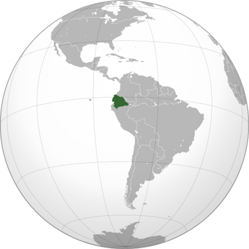
Image: Ecuador (1916–1942)

Size of this PNG preview of this SVG file: 512 × 512 pixels. Other resolution: 240 × 240 pixels.
Original image (SVG file, nominally 512 × 512 pixels, file size: 123 KB)
Description: Ecuador from 1916, when it signed its border treaty with Colombia, to 1942, when the Rio Protocol changed its border with Peru after the war between the two countries. The map is shown from the Ecuadorian point of view in the territorial dispute.
Title: Ecuador (1916–1942)
Credit: Own work
Author: AlejandroFC
Usage Terms: Creative Commons Attribution-Share Alike 4.0
License: CC BY-SA 4.0
License Link: https://creativecommons.org/licenses/by-sa/4.0
Attribution Required?: Yes
Image usage
The following 2 pages link to this image:

All content from Kiddle encyclopedia articles (including the article images and facts) can be freely used under Attribution-ShareAlike license, unless stated otherwise.
