
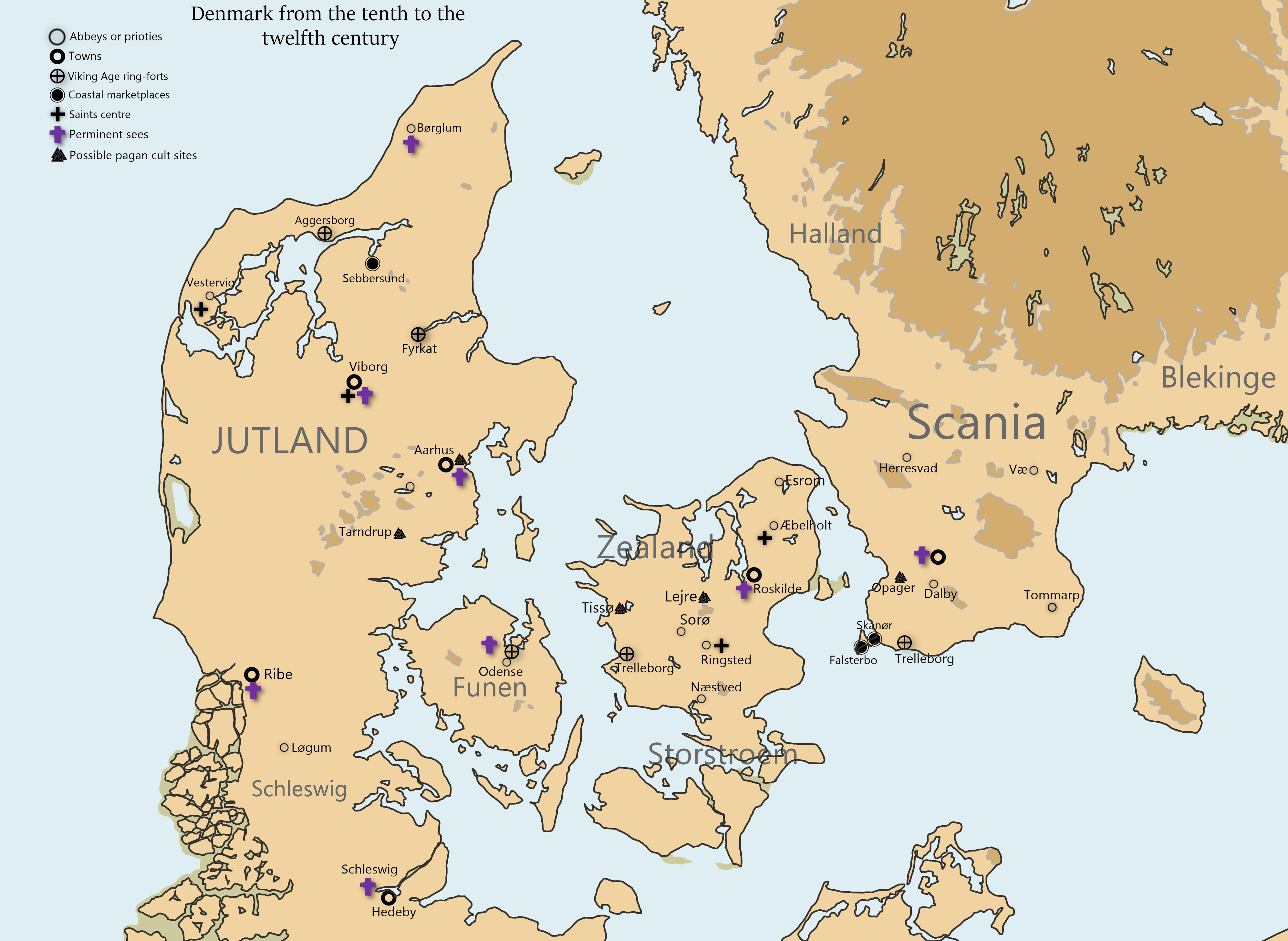
Image: Ecclesiastical map of Denmark (900-1100)
Size of this preview: 800 × 584 pixels. Other resolutions: 320 × 234 pixels | 3,988 × 2,913 pixels.
Original image (3,988 × 2,913 pixels, file size: 651 KB, MIME type: image/png)
Description: Ecclesiastical map of Denmark from the tenth to the twelfth century
Title: Ecclesiastical map of Denmark (900-1100)
Credit: Own work
Author: Tinkaer1991
Usage Terms: Creative Commons Attribution-Share Alike 4.0
License: CC BY-SA 4.0
License Link: https://creativecommons.org/licenses/by-sa/4.0
Attribution Required?: Yes
Image usage
The following page links to this image:

All content from Kiddle encyclopedia articles (including the article images and facts) can be freely used under Attribution-ShareAlike license, unless stated otherwise.
.png)