
Image: East Galicia and Volhynia 1939
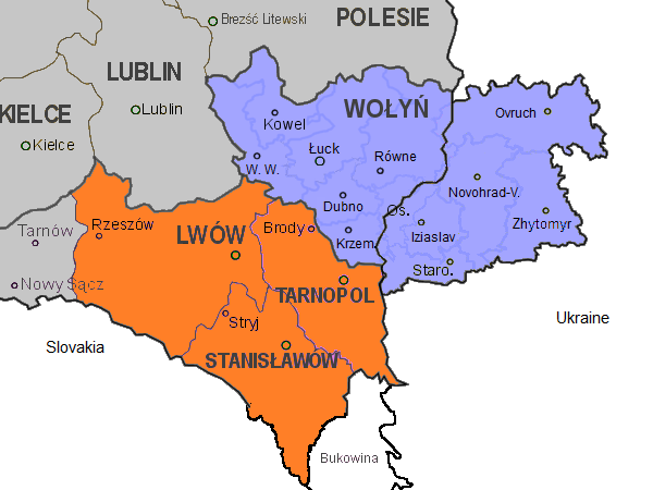
Description: Map of the south-eastern part of Poland, within the borders of 1921-1939, as well as the eastern part of Volhynia. Highlighted in orange colour are the three Polish voivodeships of Lwów, Stanisławów, and Tarnopol which form the eastern part of Galicia. Areas in grey are other Polish voivodeships. In blue the Polish voivodeship of Wołyń, with the black border separating the eastern part which was part of the Ukrainian Soviet Socialist Republic. Both parts form the historical region of Volhynia. The internal borders in blue in Volhynia are the old pre-war districts with their capital towns. Abbreviations of towns in Volhynia: W. W.: Włodzimierz Wołyński Novohrad-V.: Novohrad-Volynskyi Os.: Ostróg Staro.: Starokostiantyniv Krem.: Krzemieniec
Title: East Galicia and Volhynia 1939
Credit: Own work
Author: Gryffindor
Usage Terms: Creative Commons Zero, Public Domain Dedication
License: CC0
License Link: http://creativecommons.org/publicdomain/zero/1.0/deed.en
Attribution Required?: No
Image usage
The following page links to this image:
