
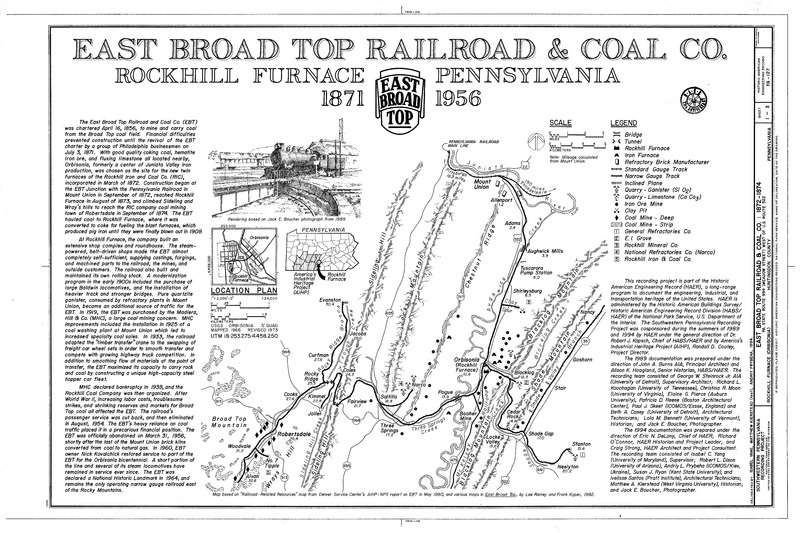
Image: EastBroadTop map
Size of this JPG preview of this TIF file: 800 × 533 pixels. Other resolution: 320 × 213 pixels.
Original image (14,450 × 9,632 pixels, file size: 1.83 MB, MIME type: image/tiff)
Description: Trackage and facilities of the East Broad Top Railroad from the Historic American Engineering Records survey.
Title: EastBroadTop map
Credit: https://www.loc.gov/pictures/item/pa1798.sheet.00001a/
Author: Isabel Yang, American Historic Engineering Record, National Park Service, US Department of the Interior. 1994.
Usage Terms: Public domain
License: Public domain
Attribution Required?: No
Image usage
The following page links to this image:

All content from Kiddle encyclopedia articles (including the article images and facts) can be freely used under Attribution-ShareAlike license, unless stated otherwise.