
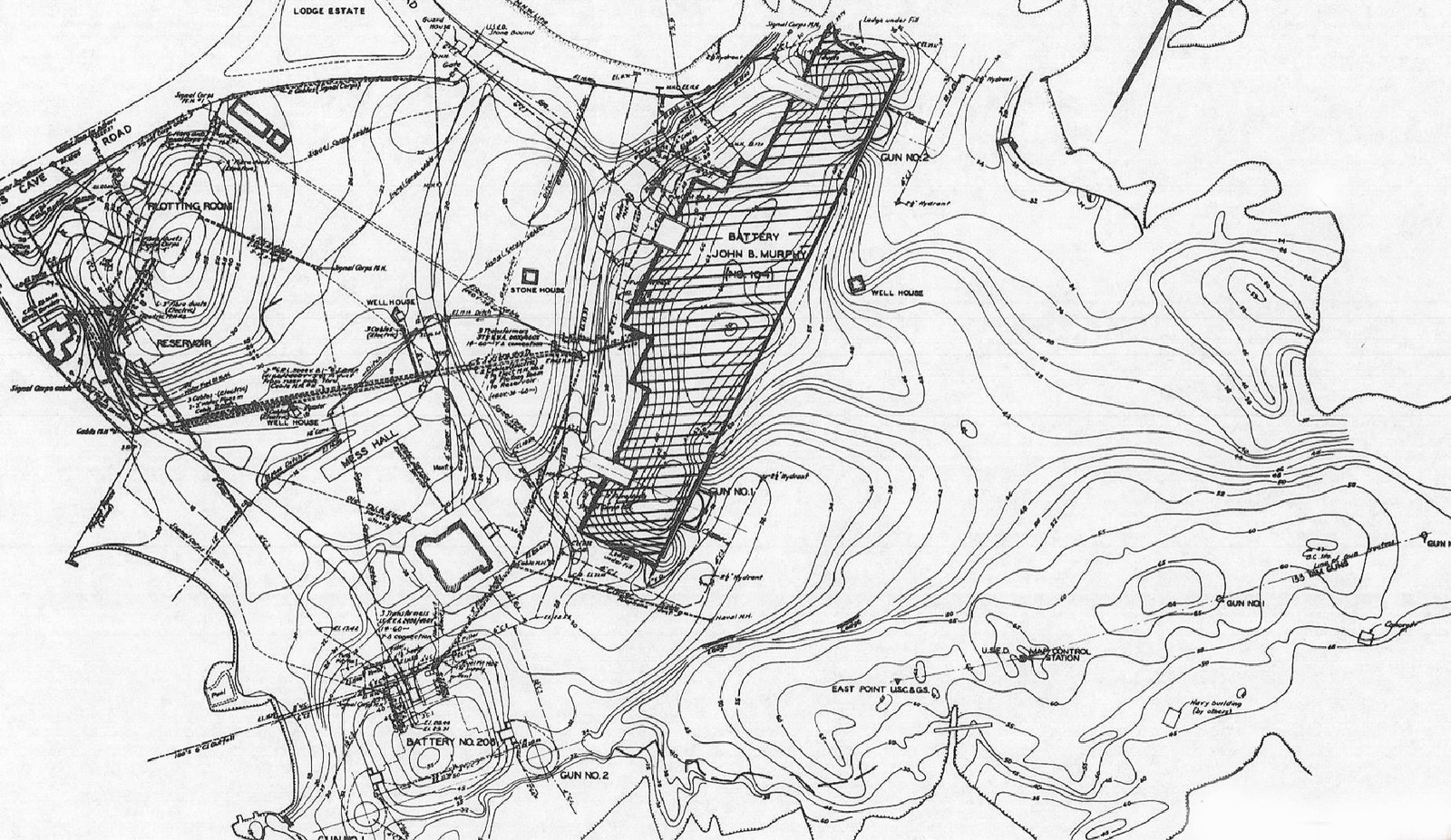
Image: East-Point-Gun-Map-1945
Size of this preview: 800 × 463 pixels. Other resolutions: 320 × 185 pixels | 1,851 × 1,072 pixels.
Original image (1,851 × 1,072 pixels, file size: 649 KB, MIME type: image/jpeg)
Description: This 1945 map showing the East Point gun emplacements is from the U.S. Army Engineers' Report of Completed Works. The southern shaft of the compass rose arrow is at upper right.
Title: East-Point-Gun-Map-1945
Credit: Own work by the original uploader
Usage Terms: Public domain
License: Public domain
Attribution Required?: No
Image usage
The following page links to this image:

All content from Kiddle encyclopedia articles (including the article images and facts) can be freely used under Attribution-ShareAlike license, unless stated otherwise.