
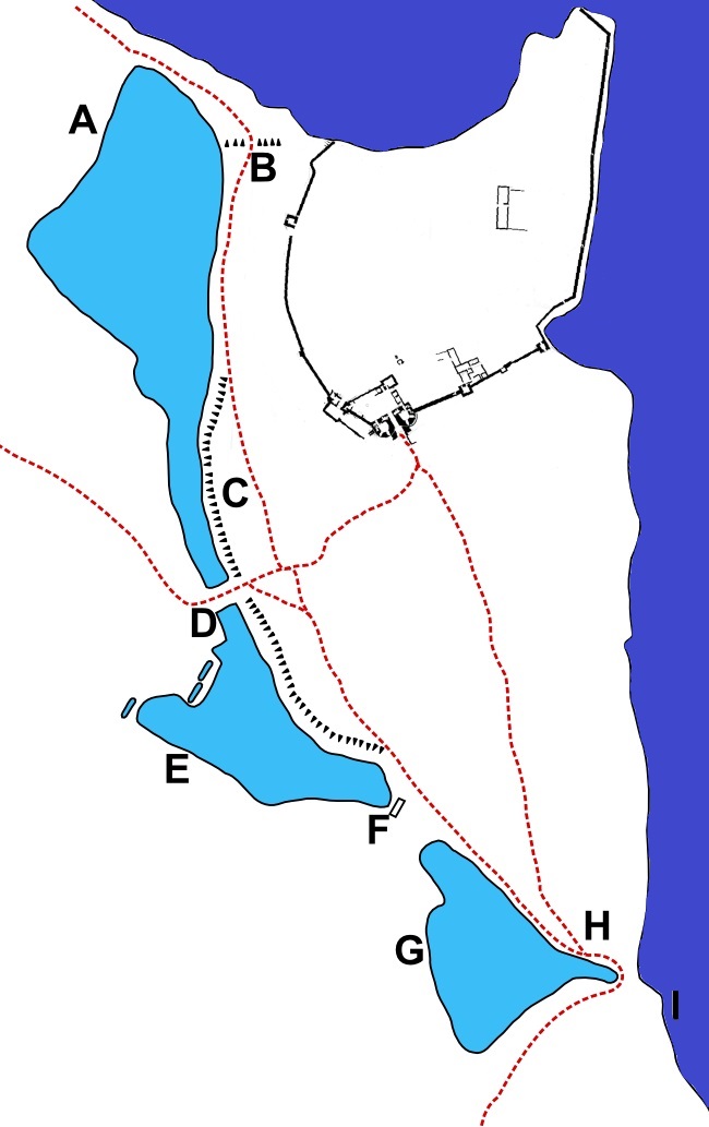
Image: Dunstanburgh Castle environ map
Size of this preview: 377 × 599 pixels. Other resolutions: 151 × 240 pixels | 650 × 1,033 pixels.
Original image (650 × 1,033 pixels, file size: 100 KB, MIME type: image/jpeg)
Description: Dunstanburgh Castle environ map; reuses the castle diagram from "Dunstanburgh Castle", Dept of the Environment, 1955, London, Her Majesty's Stationery Office, by C. H. Hunter Blair and H. L. Honeyman, on behalf of the Department of the Environment.
Title: Dunstanburgh Castle environ map
Credit: Own work, combined with reuse of castle diagram (see above)
Author: Hchc2009
Usage Terms: Public domain
License: Public domain
Attribution Required?: No
Image usage
The following page links to this image:

All content from Kiddle encyclopedia articles (including the article images and facts) can be freely used under Attribution-ShareAlike license, unless stated otherwise.