
Image: Dunkirk Evacuation shipping routes
Size of this preview: 798 × 599 pixels. Other resolutions: 320 × 240 pixels | 1,000 × 751 pixels.
Original image (1,000 × 751 pixels, file size: 182 KB, MIME type: image/png)
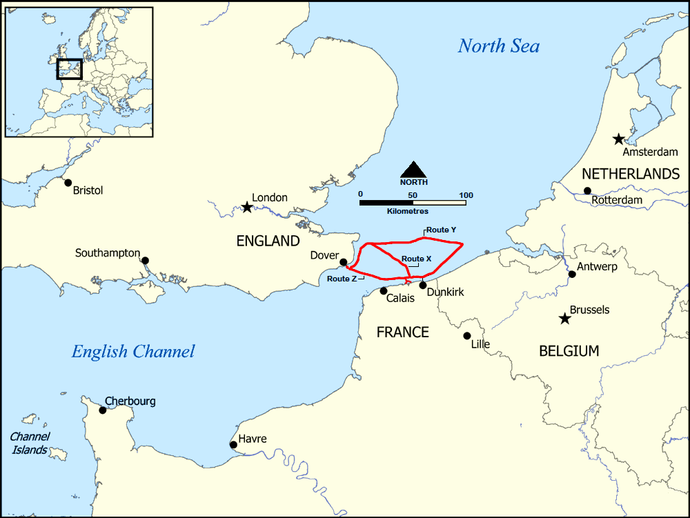
Description: This map shows the general location of the three shipping routes used during the Dunkirk Evacuation (1940).
Title: Dunkirk Evacuation shipping routes
Credit: This file was derived from Strait of Dover map.png: Information on shipping routes from Thompson, Julian (2011) [2008]. Dunkirk: Retreat to Victory. New York: Arcade. ISBN 978-1-61145-314-0. Map, page 223.
Author: Strait_of_Dover_map.png: User:NormanEinstein derivative work: Diannaa
Usage Terms: Creative Commons Attribution-Share Alike 3.0
License: CC-BY-SA-3.0
License Link: http://creativecommons.org/licenses/by-sa/3.0/
Attribution Required?: Yes
Image usage
The following 2 pages link to this image:

All content from Kiddle encyclopedia articles (including the article images and facts) can be freely used under Attribution-ShareAlike license, unless stated otherwise.