
Image: Dunedin central map

Size of this PNG preview of this SVG file: 424 × 600 pixels. Other resolution: 170 × 240 pixels.
Original image (SVG file, nominally 744 × 1,052 pixels, file size: 85 KB)
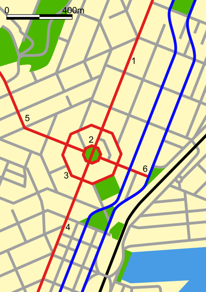
Description: Map of central Dunedin, New Zealand. The black line is the railway, the blue lines are the north/south one-way section of State Highway 1, the red lines are: George Street The Octagon Moray Place Princes Street Upper Stuart Street Lower Stuart Street
Title: Dunedin central map
Credit: self-made, based on w:Image:Dunedinmap.png map by w:user:Grutness
Author: Benchill
Usage Terms: Creative Commons Attribution-Share Alike 3.0
License: CC-BY-SA-3.0
License Link: http://creativecommons.org/licenses/by-sa/3.0/
Attribution Required?: Yes
Image usage
The following 6 pages link to this image:

All content from Kiddle encyclopedia articles (including the article images and facts) can be freely used under Attribution-ShareAlike license, unless stated otherwise.