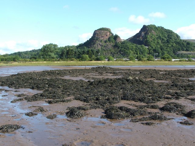
Image: Dumbuck Crannog from the south - geograph.org.uk - 933175
Description: Dumbuck Crannog from the south [See the end note for a summary of the crannog; for more detail, see the main description: 932217.] This photo shows the location of the crannog in relation to nearby features: the railway line (which runs close to the shore, just behind the grassy strip); the old Diamond Power site, whose roofs can be seen to the right; and, in the background, Dumbuck Quarry. As for the Crannog, care is needed to distinguish its original structure from more recent disturbances. For example, at its northern side (in the photo, this is directly below the left-hand peak of Dumbuck Quarry), a seaweed-covered heap of stones can be seen, and there are a few other heaps of stones at the site. These heaps are not part of the ancient structure of the crannog: rather, at some point between the 1898 archaeological dig and the later excavations in the 1990s, someone decided that it would be a good idea to shift some boulders around in order to create duck-shooting hides [see Hale and Sands, in the work cited at the link given in the first paragraph above].
Title: Dumbuck Crannog from the south - geograph.org.uk - 933175
Credit: From geograph.org.uk
Author: Lairich Rig
Usage Terms: Creative Commons Attribution-Share Alike 2.0
License: CC BY-SA 2.0
License Link: https://creativecommons.org/licenses/by-sa/2.0
Attribution Required?: Yes
Image usage
The following page links to this image:


