
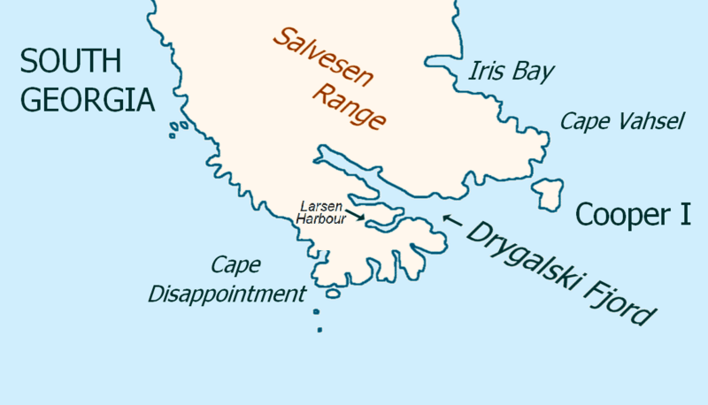
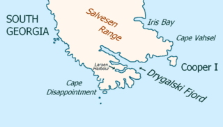
Image: Drygalski-Fjord-Map-Larsen-Harbour

Size of this preview: 800 × 458 pixels. Other resolutions: 320 × 183 pixels | 1,139 × 652 pixels.
Original image (1,139 × 652 pixels, file size: 152 KB, MIME type: image/png)
Description: Map of Drygalski Fjord, South Georgia Island, with Larsen Harbour labelled.
Title: Drygalski-Fjord-Map-Larsen-Harbour
Credit: Based on File:Drygalski-Fjord-Map.png, with the label for Larsen Harbour added.
Author: Original file created & uploaded by User:Apcbg under a PD-self license Addition made by User:Premeditated Chaos
Usage Terms: Public domain
License: Public domain
Attribution Required?: No
Image usage
The following page links to this image:

All content from Kiddle encyclopedia articles (including the article images and facts) can be freely used under Attribution-ShareAlike license, unless stated otherwise.