
Image: Dry Wood Creek Battlefield Missouri
Size of this preview: 776 × 600 pixels. Other resolutions: 311 × 240 pixels | 1,100 × 850 pixels.
Original image (1,100 × 850 pixels, file size: 262 KB, MIME type: image/jpeg)
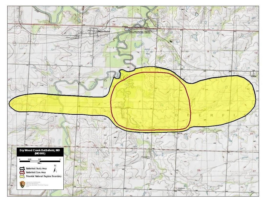
Description: Map of battlefield core and study areas. The 1993 Study Area for Dry Wood Creek originally included two separated parts. Based on new research, the ABPP determined that no fighting associated with this battle occurred in the eastern segment. Thus, that portion of the Study Area was removed. The ABPP also adjusted the Study Area to take in the breadth of the creek, a defining feature of the battlefield. The Core Area was reduced slightly to more accurately follow topographic features.
Title: Dry Wood Creek Battlefield Missouri
Credit: National Park Service
Author: American Battlefield Protection Program
Usage Terms: Public domain
License: Public domain
Attribution Required?: No
Image usage
The following page links to this image:

All content from Kiddle encyclopedia articles (including the article images and facts) can be freely used under Attribution-ShareAlike license, unless stated otherwise.