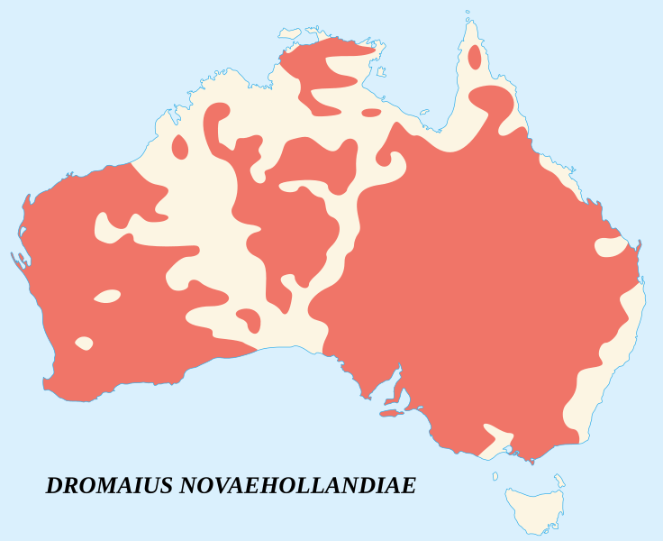
Image: Dromaius novaehollandiae map distribution 2

Description: English: Emu's recorded observations map (Dromaius Novaehollandiae). Areas where emu has been recorded.
Title: Dromaius novaehollandiae map distribution 2
Credit: English: Base map : NASA Shuttle Radar Topography Mission (SRTM30 v.2) (public domain) Edited with dlgv32 Pro (version 8.01), free limited version of Global Mapper, software from the United States Geological Survey (USGS) Projection : Mercator Projection Vectorized and modified with Inkscape. Data : Image:Emu distribution.png (original data taken from "The Atlas of Australian Birds, M. Blakers, S. J. J. F. Davies, P. N. Reilly; (1984). Melbourne University Press.")
Author: Sémhur (talk)
Usage Terms: Free Art License
License: FAL
License Link: http://artlibre.org/licence/lal/en
Attribution Required?: Yes
Image usage
The following page links to this image:

