
Image: DosCuadrasMap-USGS
No higher resolution available.
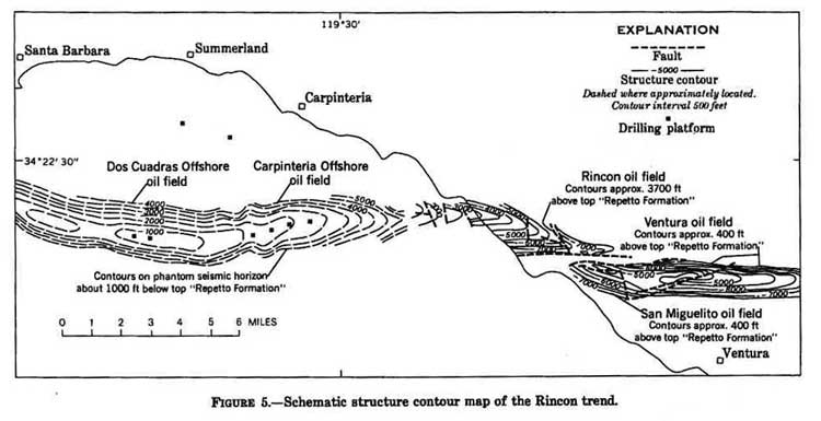
DosCuadrasMap-USGS.jpg (750 × 385 pixels, file size: 39 KB, MIME type: image/jpeg)
Description: Structure contour map of the Rincon trend, Ventura and Santa Barbara counties, California, showing relation of trend to onshore and offshore oil fields.
Title: DosCuadrasMap-USGS
Credit: J.G. Vedder, H.C. Wagner, and J.E. Schoellhammer (1969) "Geologic framework of the Santa Barbara Channel region," in "Geology, Petroleum Development, and Seismicity of the Santa Barbara Channel region, California, US Geological Survey, Professional Paper 679A, p.10.
Author: J.G. Vedder, H.C. Wagner, and J.E. Schoellhammer
Permission: US federal government
Usage Terms: Public domain
License: PD
Attribution Required?: No
Image usage
The following page links to this image:

All content from Kiddle encyclopedia articles (including the article images and facts) can be freely used under Attribution-ShareAlike license, unless stated otherwise.