Image: Donnan plat 1916
Donnan_plat_1916.png (355 × 468 pixels, file size: 251 KB, MIME type: image/png)
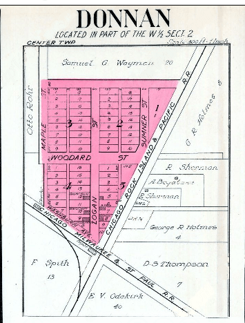
Description: Plat map of the town of Donnan in 1916, showing the locations of six houses on Logan Street, the railroad depot, and a number of farmhouses at the edge of town.
Title: Donnan plat 1916
Credit: http://www.historicmapworks.com/Map/US/40945/Lima++Donnan++Albany++Hawkeye++Alpha++St++Lucas/Fayette+County+1916/Iowa/
Author: George A. Ogle & Co.
Usage Terms: Public domain
License: Public domain
Attribution Required?: No
Image usage
The following page links to this image:

All content from Kiddle encyclopedia articles (including the article images and facts) can be freely used under Attribution-ShareAlike license, unless stated otherwise.

