
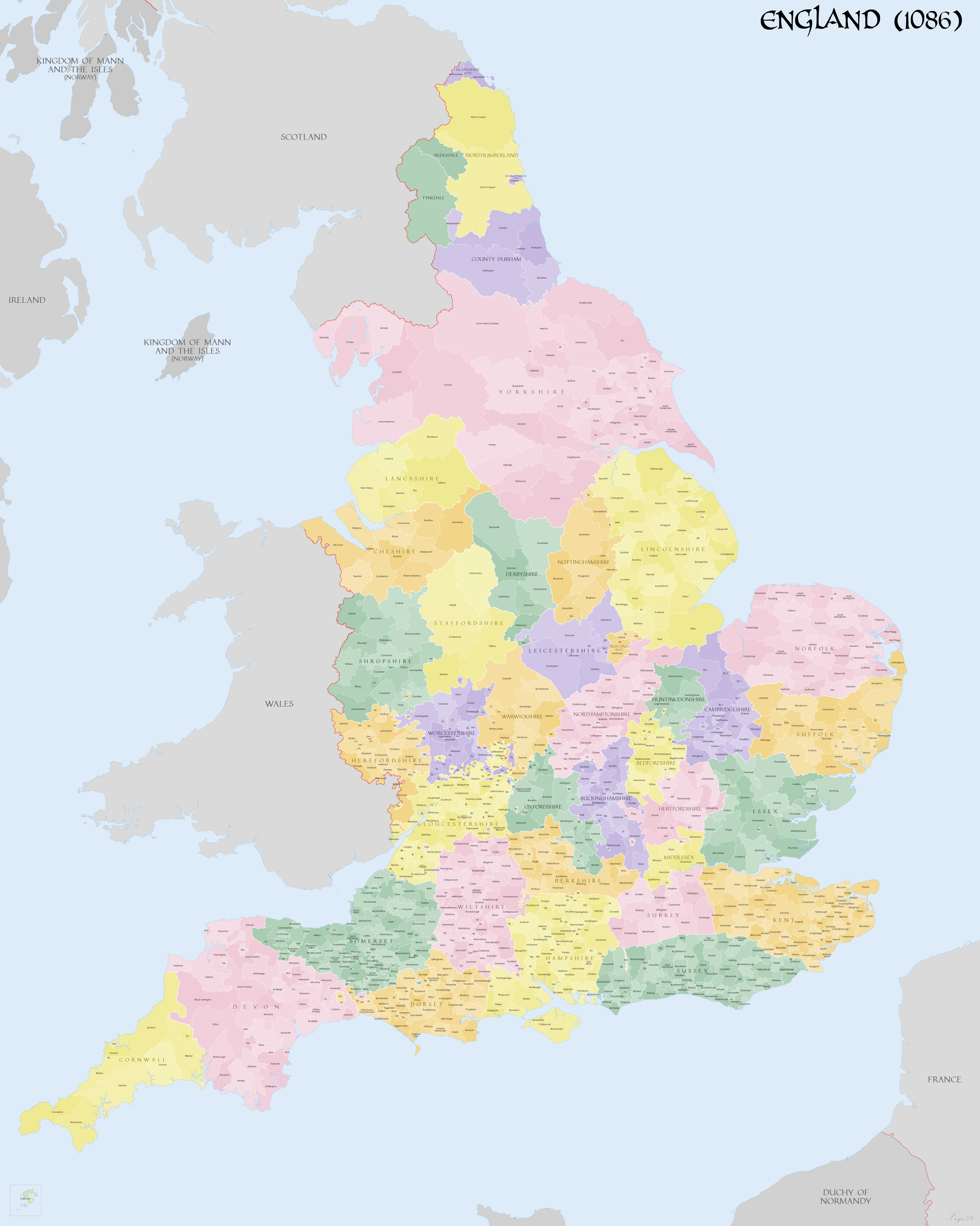
Image: DomesdayEnglandMap
Description: Map of English Counties in 1086 showing hundreds, wapentakes, wards. Source data: GIS data from The Landscapes of Governance Projects (http://www.ucl.ac.uk/archaeology/research/projects/assembly/index). Norman England - A Literary and Historical Atlas of Europe (Bartholemew). Domesday place names (K. Briggs). Vision of Britain (http://www.visionofbritain.org.uk) Open Domesday (http://opendomesday.org). Olof Anderson - The English Hundreds Names, University of Lund (1934). Victoria County History of Lancashire. Victoria County History of Rutland.
Title: DomesdayEnglandMap
Credit: Own work
Author: XrysD
Usage Terms: Creative Commons Attribution-Share Alike 4.0
License: CC BY-SA 4.0
License Link: https://creativecommons.org/licenses/by-sa/4.0
Attribution Required?: Yes
Image usage
The following page links to this image:
