
Image: Docklands map

Size of this PNG preview of this SVG file: 340 × 216 pixels. Other resolution: 320 × 203 pixels.
Original image (SVG file, nominally 340 × 216 pixels, file size: 171 KB)
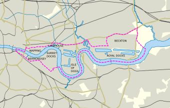
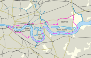
Description: This, according to LDDC, the London Docklands Development Corporation, is the Docklands area. The area is detailed in several maps in the March 1998 "Docklands Regeneration Statement". This map is based on File:Greater_London_UK_location_map.svg, and used images from the above mentioned document as reference.
Title: Docklands map
Credit: Own work
Author: Lommes
Usage Terms: Creative Commons Attribution-Share Alike 3.0
License: CC BY-SA 3.0
License Link: https://creativecommons.org/licenses/by-sa/3.0
Attribution Required?: Yes
Image usage
The following page links to this image:

All content from Kiddle encyclopedia articles (including the article images and facts) can be freely used under Attribution-ShareAlike license, unless stated otherwise.