Image: Dixon (1842)

Size of this preview: 462 × 599 pixels. Other resolutions: 185 × 240 pixels | 9,021 × 11,692 pixels.
Original image (9,021 × 11,692 pixels, file size: 10.14 MB, MIME type: image/jpeg)
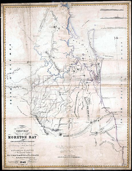
Description: This map of Moreton Bay. The first accurate map of Moreton Bay, Queensland. Compiled from authentic surveys and containing all the latest discoveries made by exploring parties is most respectfully dedicated to His Grace the Duke of Cleveland by his most obedient servant Robert Dixon. Based on trigonometric survey.
Title: Dixon (1842)
Credit: Robert Dixon, This map of Moreton Bay, National Library of Australia, MAP RM 1074
Author: Robert Dixon (1800–1858)
Usage Terms: Public domain
License: Public domain
Attribution Required?: No
Image usage
The following page links to this image:

All content from Kiddle encyclopedia articles (including the article images and facts) can be freely used under Attribution-ShareAlike license, unless stated otherwise.
