
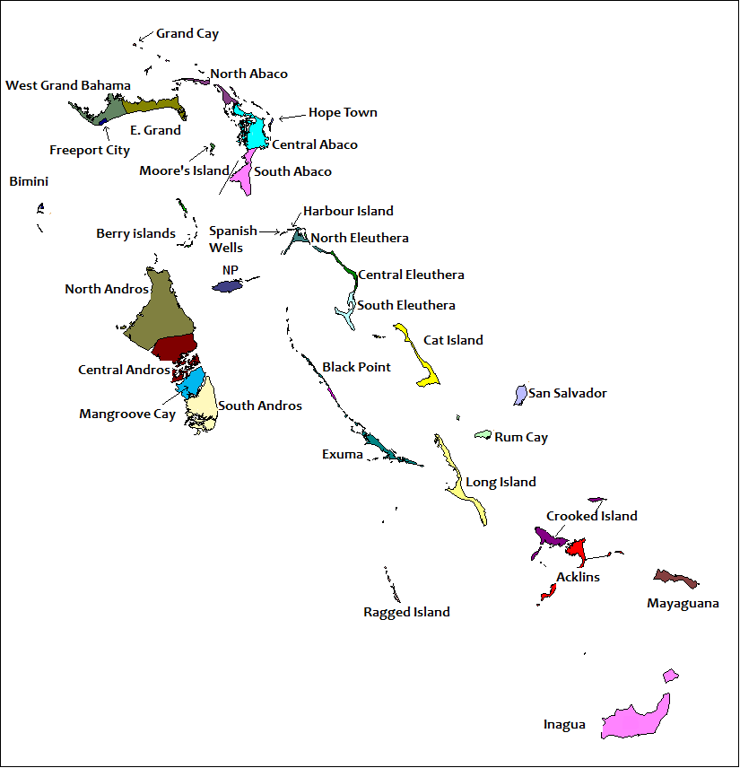
Image: Districts of the Bahamas (Labeled)
Size of this preview: 578 × 600 pixels. Other resolutions: 231 × 240 pixels | 825 × 856 pixels.
Original image (825 × 856 pixels, file size: 36 KB, MIME type: image/png)
Description: == Summary == Created by Rarelibra for public domain use. Created using MapInfo Professional v7.5 and referencing various Bahamian map sources. en:Category:Maps of the Bahamas
Title: Districts of the Bahamas (Labeled)
Credit: Districts_of_the_Bahamas.png
Author: Districts_of_the_Bahamas.png: User Rarelibra on en.wikipedia derivative work: ~~Districts of the Bahamas (Labeled).png~~
Usage Terms: Public domain
License: Public domain
Attribution Required?: No
Image usage
The following page links to this image:

All content from Kiddle encyclopedia articles (including the article images and facts) can be freely used under Attribution-ShareAlike license, unless stated otherwise.
.png)