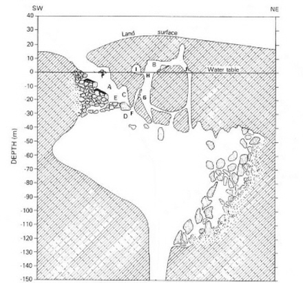
Image: Devils Hole map 2005
Description: SW-NE section of Devils Hole, NV (modified from Riggs and others, 1994, “Tectonic Speleogenesis of Devils Hole...”, Quaternary Research v. 42, p. 241–254), which in turn was modified from one by W. L. Acree, National Park Service, May 1973, library, Death Valley National Monument, Death Valley, CA. The locations of several images (figures) in this Picture Story are referenced to letters A–J in this figure. Additional information: Devils Hole Picture Story Principal investigator: Isaac J. Winograd, U.S. Geological Survey (retired). Principal research dive team: Alan C. Riggs, U.S. Geological Survey (retired); Peter T. Kolesar, Professor Emeritus, Utah State University, Logan, Utah; and Ray J. Hoffman, U.S. Geological Survey [...]
Title: Devils Hole map 2005
Credit: https://www.sciencebase.gov/catalog/item/58053885e4b0824b2d1c1e10
Author: USGS
Usage Terms: Public domain
License: Public domain
Attribution Required?: No
Image usage
The following page links to this image:


