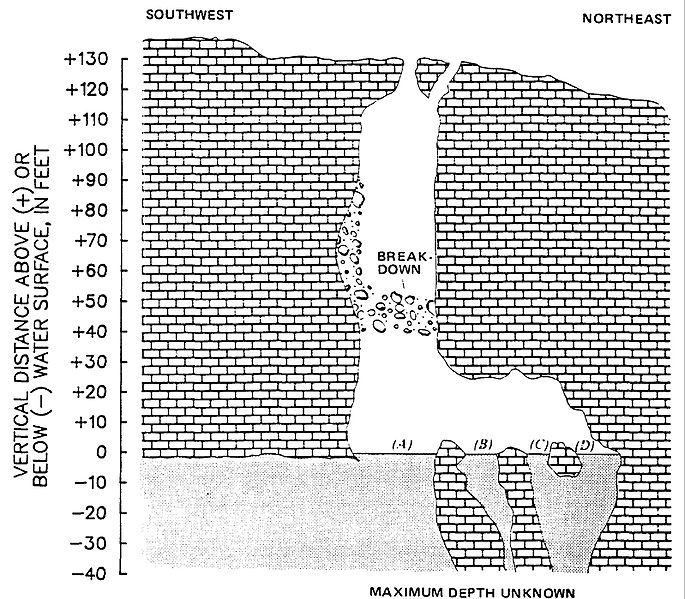
Image: Devils Hole Cave map

Description: Sketch showing underground features of Devils Hole Cave, Nevada above and below water surface (modified from a drawing by William M. Brown, 1987). .4 , main pool;B-D, smaller pools northeast of main pool. Location of pools with respect to one another is approximate Access to the main pool was gained by using an 80-foot steel-cable ladder attached at land surface, then crawling through the 2- to 3-foot-wide opening in the cemented breakdown at the 50-foot level, and finally "shuffling" down to the crescent-shaped pool (which is about 5 feet wide). Horizontal scale is approximately the same as that indicated for the vertical scale.
Title: Devils Hole Cave map
Credit: https://pubs.usgs.gov/of/1988/0093/report.pdf
Author: USGS
Usage Terms: Public domain
License: Public domain
Attribution Required?: No
Image usage
The following page links to this image:

