
Image: Devil's Backbone Battlefield Arkansas
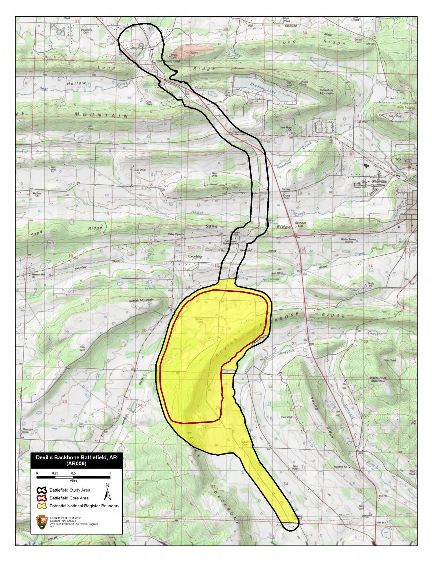
Description: Map of battlefield core and study areas. The ABPP narrowed the Study Area to follow more precisely the retreat route used by Cabell’s troops. The Study Area was expanded slightly around Old Jenny Lind to include the location of a skirmish there on the morning of September 1, a preliminary attempt by the Confederates to slow the Federal advance to Devil’s Backbone. The Core Area was reduced in the east to better reflect the vicinity of fighting along the roads used by the retreating Confederate brigade.
Title: Devil's Backbone Battlefield Arkansas
Credit: National Park Service
Author: American Battlefield Protection Program
Usage Terms: Public domain
License: Public domain
Attribution Required?: No
Image usage
The following page links to this image:
